#56: A journey through time with loess deposits
Loess deposits are an excellent source of information and are therefore used to reconstruct environments and climates in former times. A master's thesis investigated different soil profiles in Poland.
-
- Fieldwork in Lower Silesia, Poland (Picture: J. Waroszewski)
Loess is a sediment deposited by the wind. It is used in the field of geochronology to reconstruct the changes of past environments and climates. But what is loess exactly? It belongs to the most fertile soils in the world, mainly due to its silt content of up to 90%. This ensures the supply of plant-available water, soil aeration, extensive penetration by plant roots and ease of cultivation. Due to its high amount of silt, loess is easily transported by wind and its deposits can thus be found on the lee site of hills. These loess deposits can be used to draw conclusions about the origin of the wind-blown dust, the time of the deposition or what impact they have on soil formation.
-
- Profile of a Luvisol with a characteristic loess mantle (Picture: J. Waroszewski)
Loess deposits in southwestern Poland
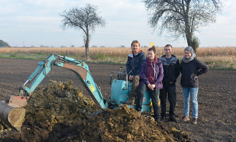
In this master's thesis five different soil profiles in Lower Silesia (Poland) were studied. The goal was to investigate the heavy and clay minerals, but also to study the geochemical and physical soil parameters. When bedrock weathering occurs, certain minerals are released. The types of minerals and the geochemistry vary along with the bedrock. The same pattern is observed in loess deposits. When loess weathers, certain minerals are released and transported to deeper layers of the soil and contribute to the development of soils. From existing literature, we know that through the weathering of these minerals, soil types like Luvisol or Alisol can develop.
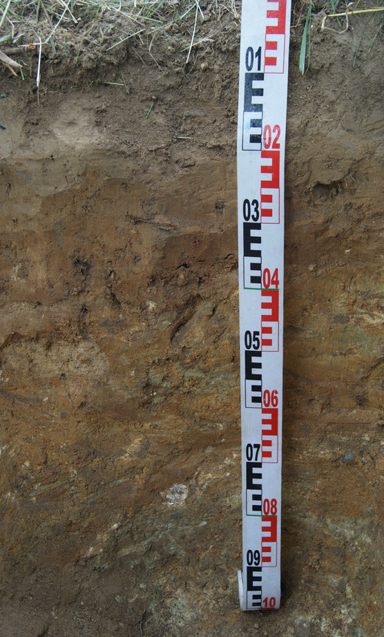
For this master's thesis five different bedrocks were chosen: Permian sandstone, basalt, granite, serpentinite, and glacio-fluvial material. To trace back the minerals to the loess or the bedrock, each profile was divided into three horizontal sections. The subdivision of the profile should help to understand which minerals originated from the bedrock and traveled upwards and which minerals were from the loess deposits and moved downwards.
Origin of the loess
Consequently, the first research question was which minerals have their origin in the loess deposits and which minerals originate from the underlying bedrock. The second research question dealt with the origin of the loess deposits. Do all five study sites have the same loess source or are there differences in geochemistry which could give a clue of their origin?
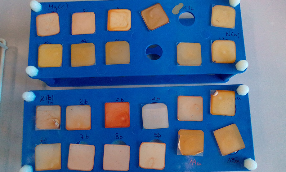
We discovered different mineral and geochemistry patterns between the five soil profiles. Additionally, observing the three sections in each profile we found different dominant minerals in each section. Hereafter, an example is shown with the soil profile having basalt as underlying bedrock. In the distribution of the heavy minerals we observed a high amount of the minerals ulvospinel, olivine and pyroxene near the bedrock while these three minerals showed a content decrease towards the surface. The mentioned minerals are characteristic for basalt and were interpreted as its weathering products.
-
- A glimpse of heavy minerals under a scanning electron microscope (SEM) (Picture: J. Kierczak)
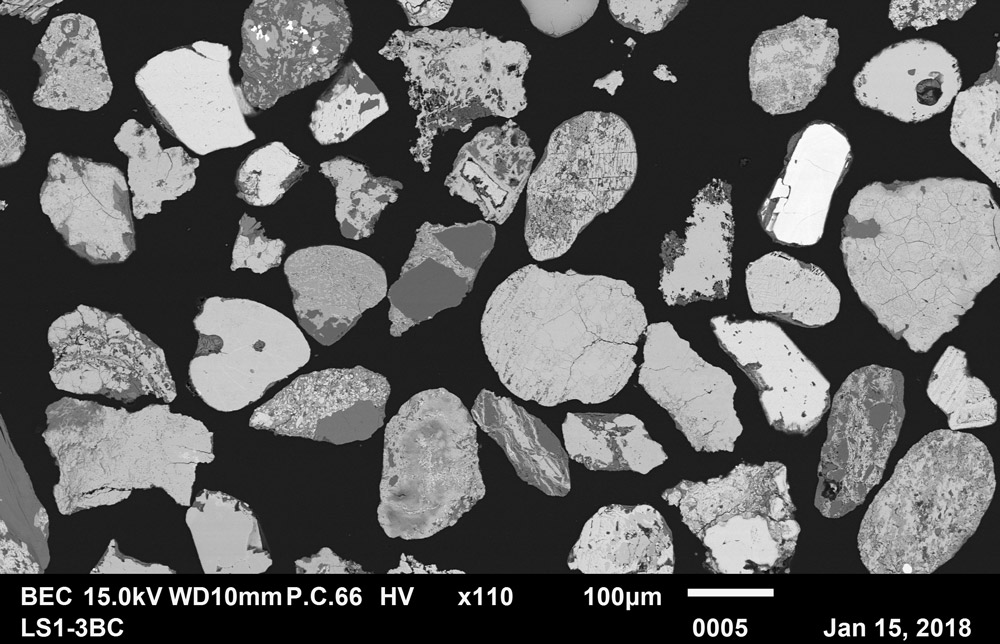
On the contrary, we observed higher amounts of zircon or rutile in the upper layers which are characteristic for loess deposits. Regarding the clay minerals, transformations were observed due to weathering. In all loess deposits higher smectite contents were found which are a typical transformation product of the clay mineral mica. The clay minerals also provided insight into the downward clay translocation and thus helped to understand how the different soil types developed. Consequently, the different underlying substrate and the covering loess deposits have an impact on soil formation.
-
- Extracted clay on glass slides ready for XRD-measurements (Picture: M. Vögtli)
The calculation of element ratios (e.g. Ti/Zr and K/Rb) revealed that the provenance of the studied loess deposits was comparable with results from Germany. Most probably the loess originates from the vegetation poor periglacial areas during Last Glacial Maximum when the Scandinavian ice sheet covered northern Europe, but the southern lying Sudety mountains cannot be excluded as a possible loess source because silt production occurs also in high altitude regions through frost shattering.
For a conclusive answer regarding the origin of the loess more data is needed. The results of this thesis contribute to basic research because little is known how loess deposits and different bedrocks affect soil development.
Weitere News
- #125: Der 125. und letzte
- #124: Gletscher vor 125 Jahren und heute
- #123: Ist das Navi in der Hand der erste Schritt zum betreuten Wohnen?
- #122: In eine neue Welt katapultiert
- #121: How to make health care service provision more equitable and greener
- #120: Unsere Welt ist eine multidimensionale Collage
- #119: Is Tourism the Beginning or the End? Livelihoods of Georgian Mountain People at Stake
- #118: «Wir müssen den Klimawandel systematisch als Risiko mitdenken»
- #117: Andean mountain regions: Fragile sentinels of landscape and cultural transformation
- #116: Temporary streams at the doorsteps of Irchel Campus
- #115: Schneeflocken vom Weltraum aus zählen
- #114: Provokation und Revolte am GIUZ
- #113: Ambitious goals for biodiversity urgently needed!
- #112: "The Eyes Have It!" - Where we look while navigating
- #111: Investigating plants genetic structure from above
- #110: «I see and I remember. I do and I understand.»
- #109: «Für uns, unsere Kinder und Kindeskinder»
- #108: Was macht die Digitalisierung mit unserer Umwelt?
- #107: The role of a developer at GIUZ
- #106: Dem unterirdischen Wasser auf der Spur
- #105: Was der Geographieunterricht zur Bildung im 21. Jahrhundert beitragen kann
- #104: Nepal - Kein Land für alte Leute?
- #103: Klimawandel in der Schweiz: Alles, was du wissen musst!
- #102: Wie Instagram unseren Umgang mit der Natur verändert
- #101: Numbed by navigation technologies: How can we counteract?
- #100: Das ist der 100. Blogbeitrag
- #99: Investigating food sustainability: from production and trade to consumption
- #98: Geographers live in concert - postponed!
- #97: Global Glyphosate: Uneven Geographies of herbicide production and use
- #96: "Pesticides burned grass and know-how"
- #95: Vier Standorte in 125 Jahren
- #94: Dietikon: Vom Bauerndorf zur Stadt
- #93: What is biodiversity?
- #92: Feldarbeit im ruralen Nepal: Reflektion zu Positionalität, Verantwortung und Rollen
- #91: Das Schulfach Geographie: heute und morgen
- #90: Funktionale Diversität aus dem Weltraum kartieren
- #89: Adieu ewig’ Eis
- #88: Landschaftsleistungen erlebbar machen
- #87: What is the role of variability in nature?
- #86: The Skin of Chitwan
- #85: Animated flight line collection over Switzerland
- #84: Space, Nature & Society: Wo wir forschen und was wir tun
- #83: Do you know about the 3MT competition?
- #82: An academic career in ecology
- #81: Hunderte Studierende verzaubern den Semesterstart an der Uni Zürich
- #80: Wie bewegen wir uns in Zukunft fort?
- #79: Willkommen im GEO- und ESS-Studium!
- #78: Expedition vom Fenster aus: Wie nimmst du deine Umgebung wahr?
- #77: Mitten in der Pandemie eine historische Pandemie untersuchen
- #76: Das Geoteam stellt sich vor
- #75: How roots influence climate change
- #74: Imaging the earth from above
- #73: Studierende sammeln Daten: Natur, Landschaft und Ressourcen
- #72: Trouvaillen aus dem Archiv
- #71: The fluorescence of phytoplankton from 800 km above
- #70: Der kalte Norden ist auch familiär
- #69: How the COVID-19 pandemic is teaching us to tackle the climate crisis
- #68: Studierende sammeln Daten: Migration, Mobilität und Stadt
- #67: Sommerpause!
- #66: On the art of failing forward
- #65: Die Wasserstadt Zürich mit dem Smartphone entdecken
- #64: Auf den Spuren der ersten Schweizer Polarforscher
- #63: Geistreiche Wortspiele
- #62: Von Gemüse über Milch bis zu Kaffee: Solawis in der Deutschschweiz
- #61: Berner Seeland - quo vadis?
- #60: Intense days on the field course to Val Piora
- #59: Panta rhei - alles fliesst
- #58: Comic Strip Geographies
- #57: Where we come from
- #55: Schlacht am Morgarten 1315: Wie sah die Landschaft damals aus?
- #54: Berne going green
- #53: Biochar increases rice root architecture
- #52: Velo- und Fussverkehr in der Corona-Zeit
- #51: The impact of Covid-19 from an economic geography perspective
- #50: Why do we create virtual forests?
- #49: Wenn das Eis fehlt: Das Lötschental und seine Zukunft
- #48: Wie Skitouren geplant werden: Big Data gibt Einblicke
- #47: Is there a place for people in protected areas?
- #46: Artenvielfalt im Irchelpark
- #45: Cress, tomatoes and the meaning of the universe
- #44: Scientific games to understand social-ecological system dynamics
- #43: Insight into the WGMS
- #42: Connecting female hydrologists worldwide: an initiative born at GIUZ
- #41: Maximilian schickt dich einkaufen
- #40: Sars-CoV-2 and food producers: who cares?
- #39: The value of water
- #38: Mit Slimy-Masse die Gletscherschmelze illustrieren
- #37: Was machen Geographinnen und Geographen nach dem Studium?
- #36: Geographie-Student Jonathan, der Erdball und die CO2-Männli
- #35: Zwei Studiengänge am Geographischen Institut
- #34: Urban Sustainability as New Financial Fix?
- #33: Stillschweigend im Verborgenen
- #32: Interaktiv und interdisziplinär
- #31: Unpacking the complexity of social-ecological systems
- #30: Der Landschaft lauschen
- #29: Synergien zwischen Homeschooling und Hochschullehre schaffen
- #28: The first fully remote PhD defenses
- #27: Der Weltwassertag fällt ins Wasser
- #26: Die GIUZ Sustainability Task Force
- #25: Was ist Geographie?
- #24: «Geografe nüme schlafe!»
- #23: Auf dem Weg zur 2000-Watt-Gesellschaft
- #22: Spatial genetics for plant-based communities - and much more!
- #21: Strebergärtli - Irchel Garden Project
- #20: Writing papers - a nightmare. Or not?
- #19: Urbanisierte Landschaften - Leben zwischen Natur und Zivilisation
- #18: Atmende Wälder in 3D
- #17: «Wir sind hier, wir sind laut!»
- #16: Was ist EGEA?
- #15: Exploring the future of biodiversity
- #14: Lawinenbulletins in den Alpen: Konsistenz über die Landesgrenzen hinweg
- #13: Ein Kaffee aus der Eiszeit
- #12: Grönland 1912 - und heute!
- #11: «Wir sitzen alle im selben Boot»
- #10: Monitoring und Reduktion von Flugreisen am GIUZ
- #9: Der Verein Geographie Alumni UZH: Ein Forum für alle Geographieinteressierten
- #8: Wissen in Bildern - Informationsdesign heute
- #7: Geographie in Aufruhr
- #6: Gletschermessreihen mit Mayonnaise
- #5: Landkarten im Reduit
- #4: Die Plastiksuppe kartieren
- #3: Neue Abteilung «Space, Nature and Society»
- #2: Wie alles begann
- #1: Alles Gute zum 125. Geburtstag