Navigation auf uzh.ch
Navigation auf uzh.ch
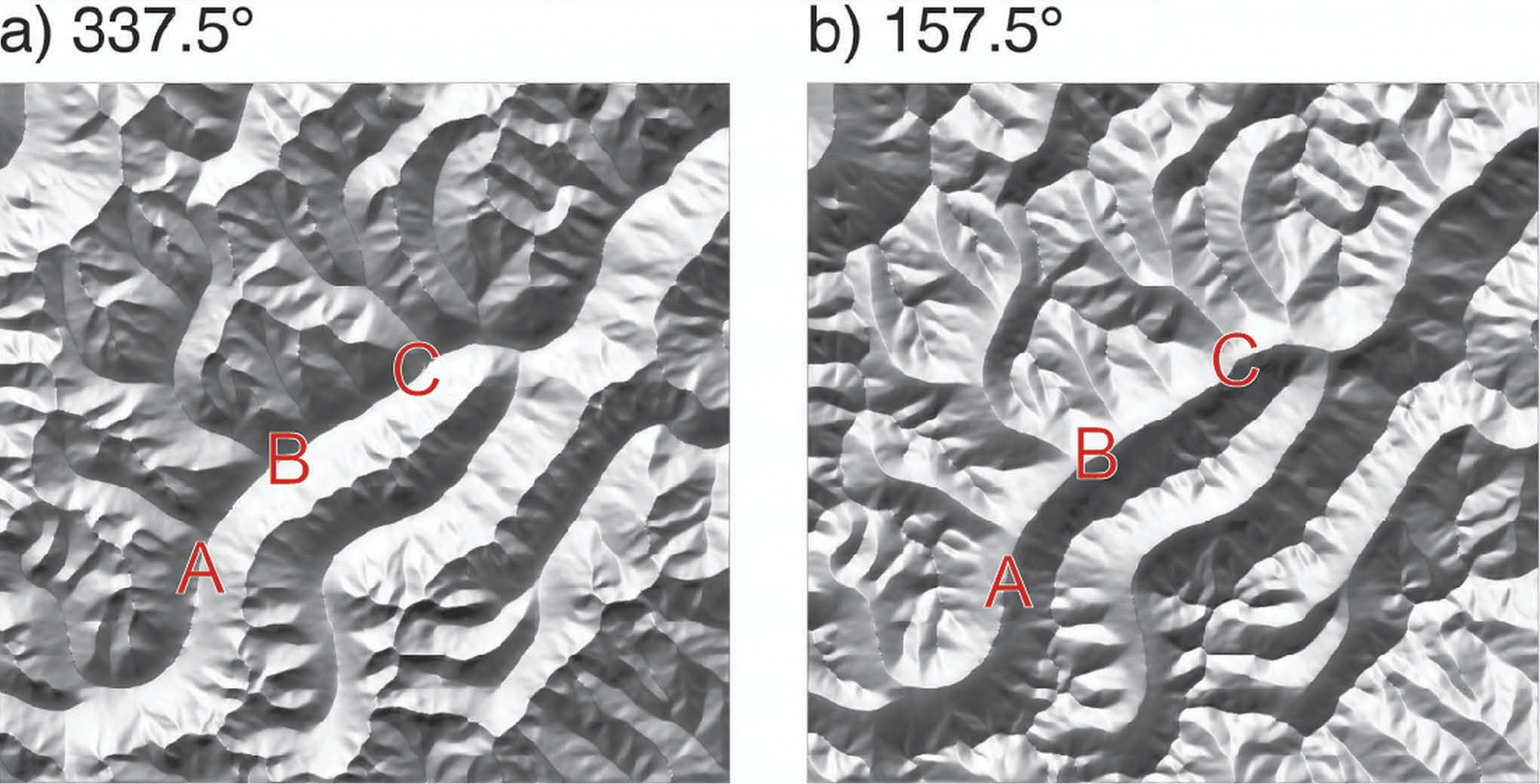
The Swiss cartographers are historically the masters of terrain representation. They know that the human brain is easily fooled into confusing ridges and valleys on maps and satellite images unless the illumination comes from the northwest. The reason remains mysterious.
In a study published earlier this year, GIUZ Alumnus Julien Biland and Arzu Çöltekin showed terrain images with differing angles of illumination to 27 volunteers and came up with a remarkably precise estimate of the optimal angle for reducing this optical illusion: 337.5 degrees, just a bit to the north of the 315 degree northwest lighting cartographers have traditionally used.