Navigation auf uzh.ch
Navigation auf uzh.ch
River networks are striking features engraved into the surface of the Earth, shaped by uplift and erosion. It is still unclear which erosional mechanisms created these distinctive geometric signatures on Earth. A new paper shows the contribution of groundwater to shaping river network branching angles.
Our recently published analysis of 1 million river junctions and 4.2 million groundwater wells across United States shows that stream network branching angles vary systematically with the degree to which streams lose or gain water from nearby aquifers. By combining new continental data sets of groundwater well levels, river water levels, and river junction angle across the United States, we reveal the first continental-scale observational evidence on the potential contribution of groundwater to shaping river network branching angles, and thus to the development of large-scale drainage patterns.
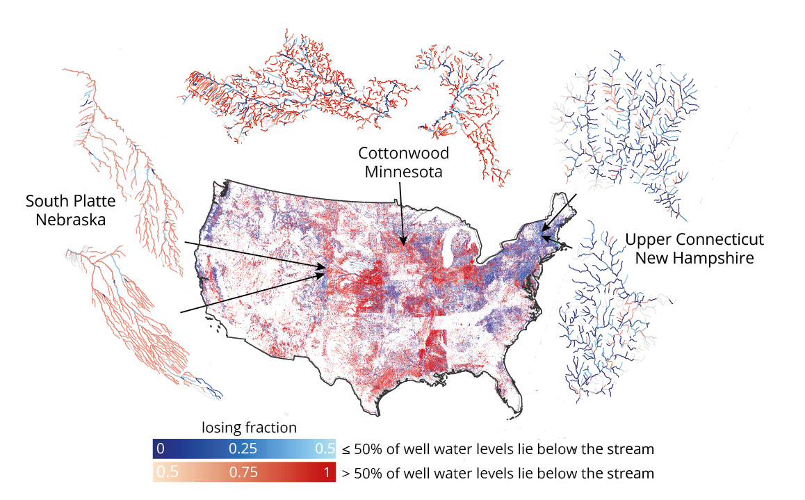
River networks across United States show a distinct west-east planform geometry with narrow stream banching angles and parallel valleys in the west where climate is dry and wide stream branching angles in the east where climate is humid. Our analysis showed for the first time that groundwater seepage contributes to these striking patterns of narrow, steep valleys in the west of United States where streams are mainly losing their water to groundwater versus wide stream branching angles and smooth valleys of the east where streams are mainly gaining water from nearby aquifers.
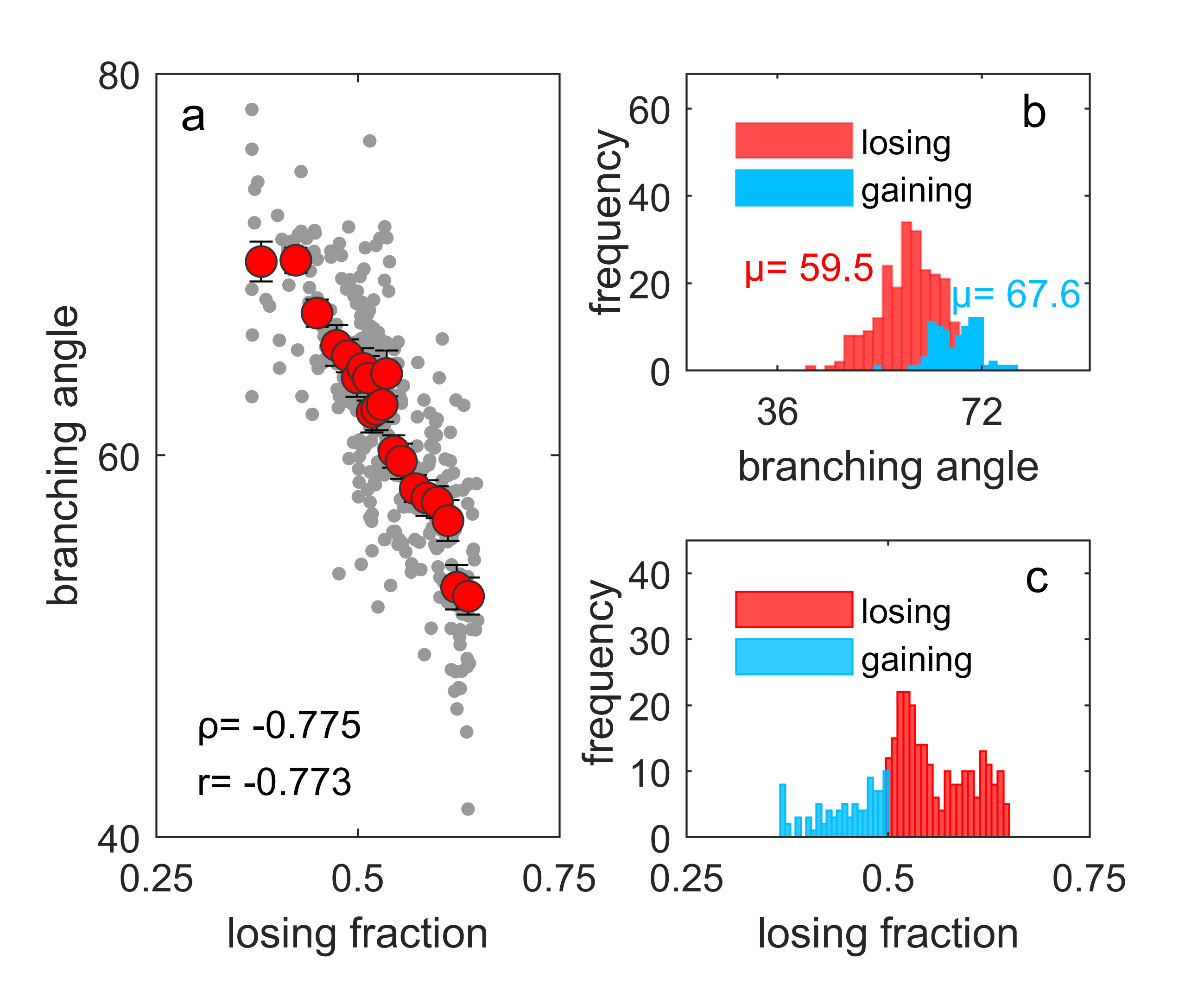
The systematic relationship between stream network branching angles and stream-groundwater water levels reveals groundwater's fingerprint in stream network planform geometry and opens an avenue to predict groundwater-surface water interactions in data-scarce areas on Earth or other planets such as Mars.
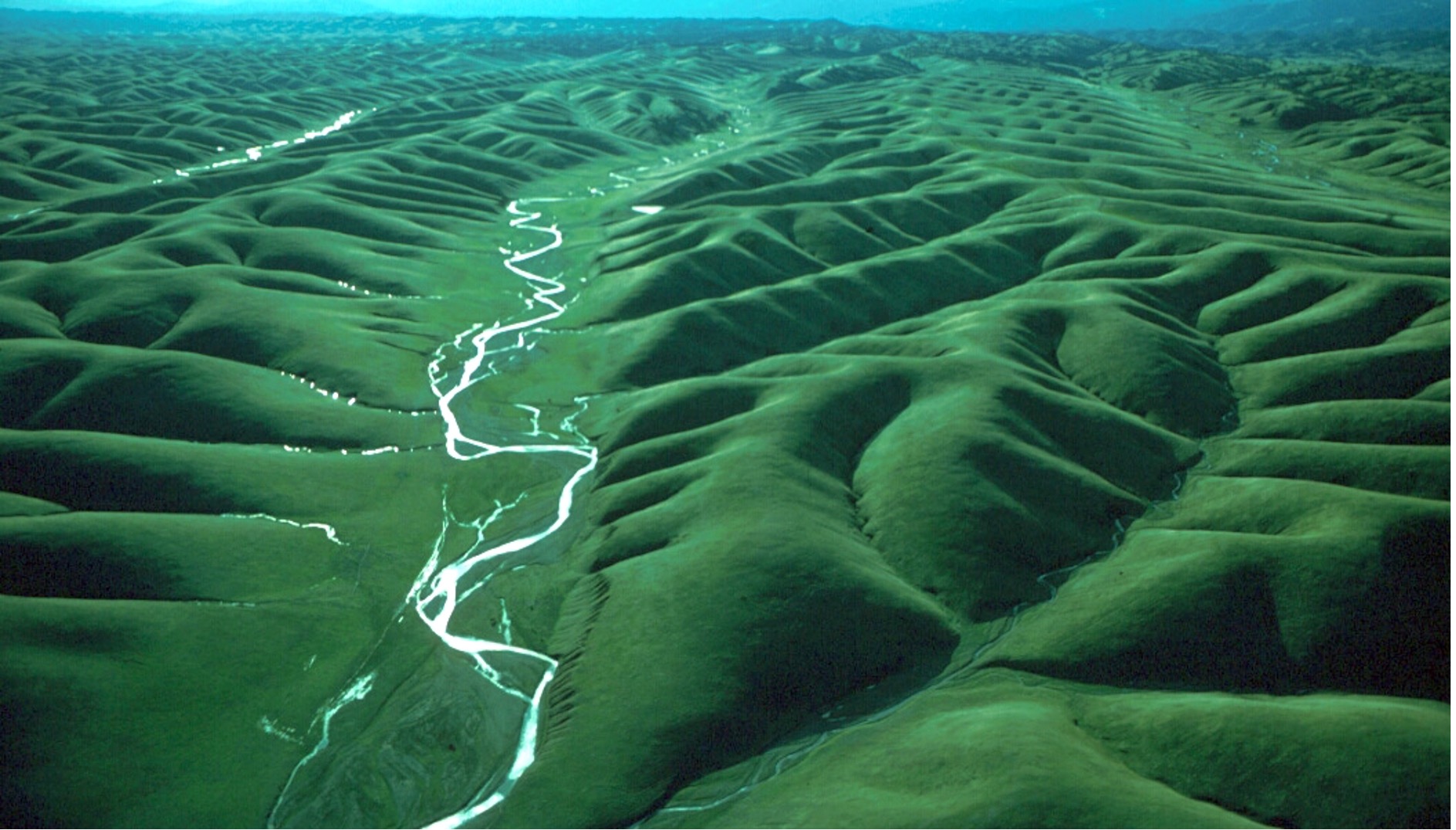
Image: Drainage network of Stony Creek near Orland, California. © James Kirchner
Elham R. Freund, Hansjörg Seybold, Scott Jesechko, James W. Kirchner:
Groundwater's fingerprint in stream network branching angles Geophysical Research Letters, 2023, DOI: 10.1029/2023GL103599.
Elham Freund