Navigation auf uzh.ch
Navigation auf uzh.ch
A new navigation system lets pedestrians decide for themselves which route to take in a given area. In this way, they can better acquire spatial knowledge and have a lot of fun during navigation.
Finding the way from A to B in the urban jungle? No problem thanks to navigation systems such as Google Maps. However, many people are hardly aware of their surroundings when using such systems and do not acquire much spatial knowledge. And they often feel patronized because they can't choose the route according to their wishes.
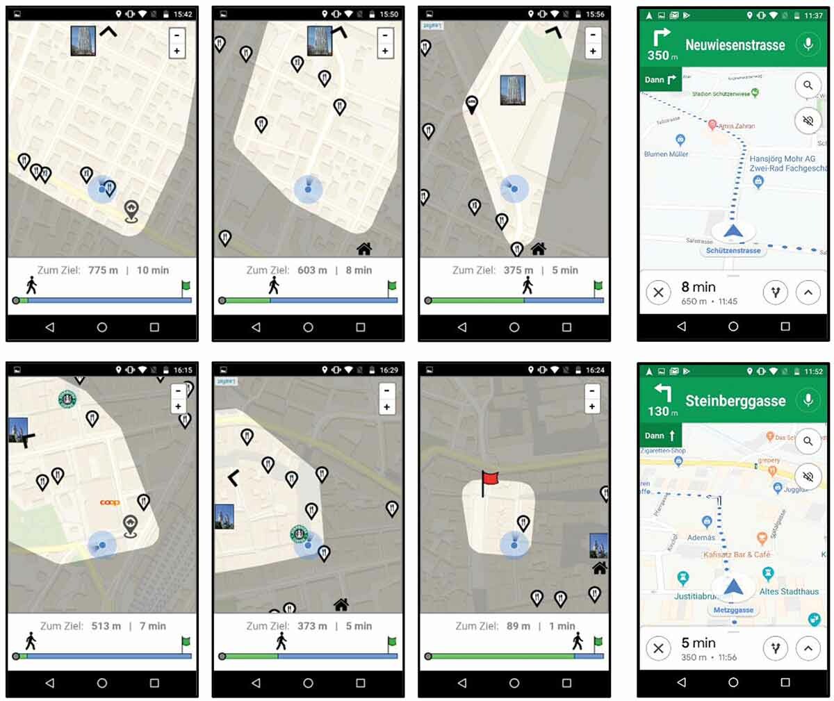
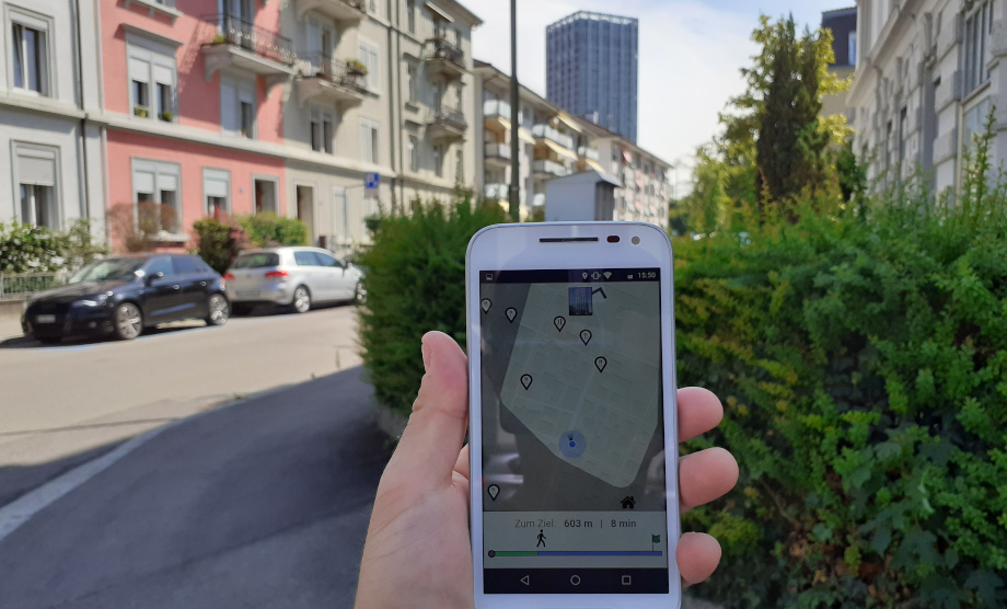
Researchers at the Department of Geography have now developed a prototype navigation system that does not restrict users to a predefined route. Rather, it defines an area on the map consisting of all potential routes they can take to reach the destination within a certain time. They decide for themselves: Do I walk along the main street or would I rather stroll through the park? As the user approaches the destination, the so-called "Potential Route Area" continuously adapts. Within this area, users can freely choose their own route and alter it anytime, and still arrive at their destination within the desired detour tolerance. Prominent landmarks such as a broadcast tower or a church are displayed on the map and help users find their way.
In the Swiss city of Winterthur, Thomas Mathis – as part of his master's thesis – had the test subjects use both the new system and the conventional turn-by-turn navigation guidance from Google Maps to get from a specified starting point to a destination. It was recorded which route users chose, how long they were on the road and how much they interacted with the navigation system.
With the novel system, the test subjects rarely followed the shortest route and also spent slightly longer on the road. However, they were better at acquiring spatial knowledge about the environment, demonstrated by their more detailed post-test drawings of the chosen route and their better estimation of directions. And they reported having had significantly more fun than when using Google Maps.
For the time being, this new navigation system remains a prototype. There are currently no plans for commercial use. "But our study shows that people appreciate the feeling of controlling a navigation system rather than being controlled by it", say the study's authors, Haosheng Huang, Thomas Mathis and Robert Weibel. "In addition, people actively engage with the environment and learn a lot about the space they're moving through." In this way, the useful could be combined with the pleasurable in many everyday situations: building up the "mental map" that helps us find our way independently in the urban jungle.
Haosheng Huang, Thomas Mathis & Robert Weibel (2021) Choose your own route – supporting pedestrian navigation without restricting the user to a predefined route, Cartography and Geographic Information Science
Thomas Mathis (2020): "Choose your own route" - Supporting pedestrian navigation without restricting the user to a predefined route. MSc Thesis, Department of Geography
Communications