Research
We aim to deepen our knowledge of real, mental, and virtual worlds to find solutions for pressing societal needs and environmental problems of the mobile digital information society, increasingly living in densely populated urban areas.
Our research lies at the interface of geographic information science, geographic information visualization/geovisual analytics, human-computer interaction, spatial cognition and perception of the environment including human mobility.
We follow three research threads involving (1) spatio-temporal visual analytics, (2) the design and development of geographic information displays, and (3) their empirical evaluation, to support affective, effective, and efficient decision making and behavior.
Spatio-temporal visual analytics

WHY? With increasing mobility of the evolving digital society, supported by smart mobile information technology, exciting opportunities arise to study mobility behaviors in situ and in real-time.
WHAT? Approaches from the fields of geography, psychology, and movement sciences allow us to deepen our understanding of spatio-temporal human mobility behaviors at various resolutions.
HOW? We apply spatial and spatio-temporal statistics to analyze movement behaviors and mobility outcomes. We base our research on various data sources, such as GPS-fixes of and interactions with smart mobile devices and available data about the traversed environment (e.g., official environmental statistics, land use and land cover data, etc.) that can be spatially integrated with mobility mapping and spatio-temporal modeling approaches.
WITH WHOM?
UZH Digital Society Initiative
CODE LAB, Prof. Arko Gosh, Leiden University, Leiden (NL)
ZHAW Sustainable Supply Chain Management and Mobility, Prof. Andrea Del Duce
Institute of Data Analysis and Process Design (IDP) ,Dr. Stephan Bütikofer and Prof. Reimond Wüst
Mobility-aware Geoservices
PUBLICATIONS
Please find our current publications here
Design and development of geographic information displays

WHY? With the ongoing digital transformation, urban spaces increasingly transform into smart and powerful, sensor and data-driven cities that influence the mobile spatial behaviour of its citizens.
WHAT? We aim to provide geographic information displays that guide mobile users' attention towards context and decision-relevant geographic information in location-based services, for affective, effective, and efficient decision making and space-time behavior. The main application is the support of intelligent mobility for a diverse population, building on smart digital infrastructures.
HOW? We study the appropriate selection and presentation of relevant geographic information for users with different backgrounds and varying needs, and develop human and user responsive geographic displays of mobility-aware geo–services for varying use contexts. We devise solutions for integrating multisource, multivariate, real-time data streams into mobile geographic information displays for informed decision making, and to guide space-time behavior. Specifically, we develop location-based services and adaptive visualization methods for serving useful and usable context-dependent geographic information for everyday situations, tailored to the mobile, digital citizen.
WITH WHOM?
SCoPe Lab - Spatial Cognition and Perception
UZH Digital Society Initiative
ZHAW| Media Linguistics: Prof. Wibke Weber
Doing Good with VR (Digital Lives)
PUBLICATIONS
Please find our current publications here
Empirical evaluation of visuo-spatial behavior and decision making
WHY? Well-designed mobile, human responsive geographic information technology could improve the lives of millions mobile smart citizens who daily need to make time critical and societally relevant decisions on the go.
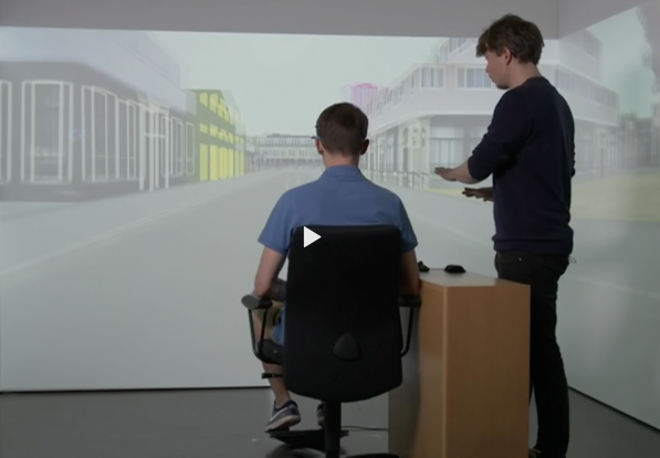
WHAT? Our objective is to create aesthetically pleasing, human, task, and context responsive geographic information displays that can be used indoors (i.e., large immersive VR, etc.) and outdoors (i.e., small mobile assistive displays, AR, etc.).
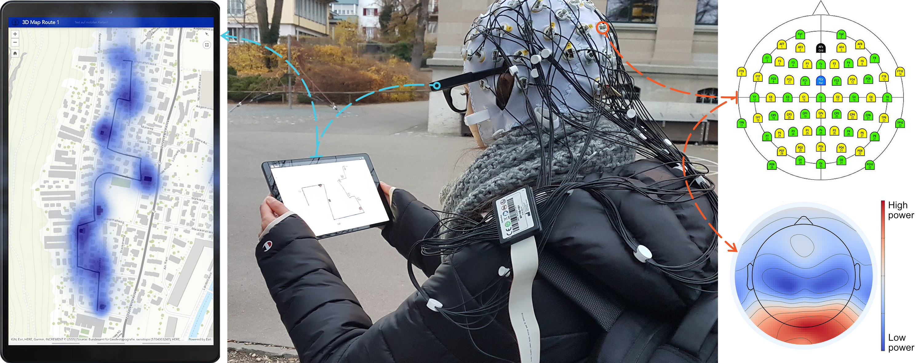
HOW? We empirically assess a broad range of geographic and non-geographic (i.e., spatialized) information displays to support space-time knowledge discovery, knowledge acquisition, decision making, and behavior. We capitalize on ambulatory, in-situ human behavior sensing methods (i.e., eye tracking, galvanic skin responses, EEG measurements, etc.) to support affective, effective, and efficient space-time decision making and behavior in real-time. Our empirical studies follow experimental design standards from the cognitive sciences including neuroscience, and are additionally grounded on state-of-the-art theories and solid design principles from cartography, information visualization, and computer vision.
WITH WHOM?
SCoPe Lab - Spatial Cognition and Perception
ERC GeoViSense
Emotive I & Emotive II
PUBLICATIONS
Please find our current publications here