New Publication
How does your viewing perspective matter for decision-making with flood risk maps?
Cartography and Geographic Information Science
Fabian Kuster, Ian T. Ruginski, S.I. Fabrikant
Abstract
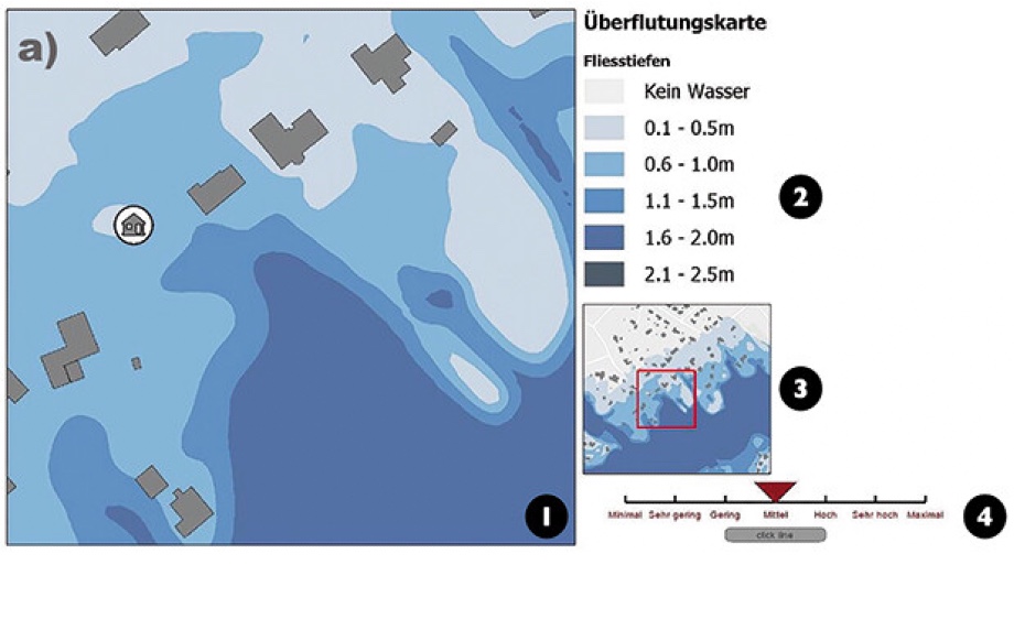
The globally increasing frequency of flood events highlights the importance of effective flood risk communication. The influence of the viewing perspective of mapped flood events on human risk perception has not yet been a research focus of the geovisualization community. This empirical study aims to fill this gap by investigating how the viewing perspective of flood risk maps, that is, 2D orthographic vs. 2.5D oblique views, influence human flood risk perception and decision-making. Results on how viewing perspective might influence measured risk perception are in line with prior inconclusive research on the utility and usability of adding a third viewing dimension on static maps. Unlike prior research would have suggested, we find that the individual risk attitude of our participants had no direct influence on their risk ratings in the context of this study. With additional empirical evidence on how static 2D and oblique 2.5D hazard maps might influence the public’s risk perception and decision-making, we hope to further inform policy and decision makers on the critical importance of well-designed cartographic displays for effective and efficient hazard and risk communication. We also provide an open-source code repository for making reproducible experiments with our static maps.
https://doi.org/10.1080/15230406.2023.2268502