ICC Conference 2021
The impact of landmark visualization style on expert wayfinder’s cognitive load during navigation.
Abstracts of the International Cartographic Association 2021, International Cartographic Conference, Dec. 14-18, 20201, Florence, Italy,
Abstracts of the International Cartographic Association 2021, International Cartographic Conference, Dec. 14-18, 20201, Florence, Italy,
Abstract
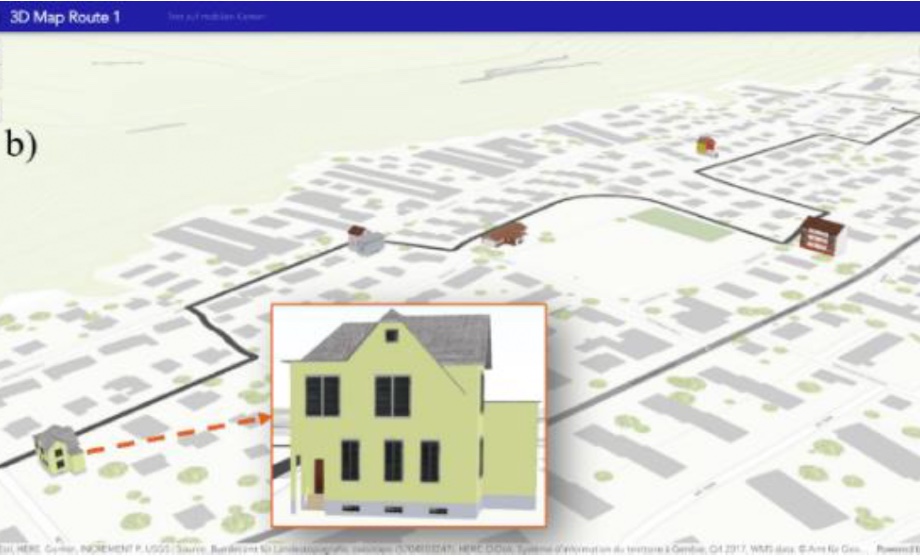
Our daily navigation and wayfinding activities are cognitively challenging processes, especially in unfamiliar environments (Farr et al., 2012). Landmarks have proven to facilitate navigation (Couclelis et al., 1987). Despite the acknowledged importance of landmarks for human navigation, it is still undecided how we should display them in a perceptually salient and cognitively supportive way on mobile maps. We aim to identify landmark designs that help redirect participants’ gaze to the traversed environment to support participants’ spatial knowledge acquisition during navigation, while also reducing participants’ cognitive load.
Landmark designs at various levels of abstraction, including 2D and 3D depictions have been proposed (Döllner, 2007; Elias & Paelke, 2008). Elias and Paelke (2008) suggest a landmark abstraction continuum for point features, ranging from 3D photorealistic (images) to 2D abstract (labels) on maps. Others have suggested fully photorealistic navigation displays in 3D (Nurminen & Oulasvirta, 2008) because these seem to facilitate landmark recognition on the navigation system display, thus making the design superior to abstract 2D maps for novice users (Plesa & Cartwright, 2008). One drawback of realistic 3D depictions is the amount of information presented to users, potentially leading to greater cognitive load and mental efforts because of the increased visual density (Liao et al., 2017). To mitigate this, Liao et al., 2017 suggest combining 2D and 3D, where only landmarks are depicted as photorealistic 3D features on the 2D mobile map.