New Publication
An augmented reality study for public participation in urban planning
Journal of Location Based Services
Ursina Christina Boos, Tumasch Reichenbacher, Peter Kiefer & Christian Sailer
Abstract
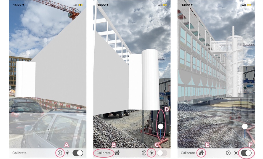
Ongoing urbanisation processes invoke immense construction activities, for which citizens often participate in planning. Yet, imagining planned buildings based on visual representations is a highly demanding task. While traditional methods, such as construction spans, 2D, or 3D visualisation often fail to offer a complete picture, we propose Augmented Reality (AR) as a more adequate tool. We first present an evaluation of the suitability of AR compared to construction spans for a future building and assess which degree of abstraction of AR is most effective, as well as difficulty of interpreting them correctly. In a between-subjects field study we compare construction spans and a prototype AR application including three levels of detail (LOD) of the same building project. Participants solve two estimation tasks using the construction spans and six estimation tasks using the AR application, before answering a questionnaire on the different visualisation methods. We find participants are confident about the potential of AR, but no significant differences between the different LOD groups in subjective assessment. Results suggest that previous knowledge (e.g. in GIS) may have a positive impact on dimension estimation performance. Also, details, such as façade elements or windows, could facilitate estimation tasks because they allow inferences about a building’s size.