#55: Schlacht am Morgarten 1315: Wie sah die Landschaft damals aus?
Die Schlacht wurde angeblich entscheidend von der Landschaft geprägt. Doch wie sah es rund um den Ägerisee damals aus? Ein integratives Projekt von Geographie-Studierenden ging im Jahr 2014 dieser Frage nach.
-
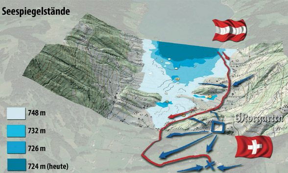
Seespiegelstände am Morgarten (Egli, Maisch, Çöltekin, Purves, 2015)
-
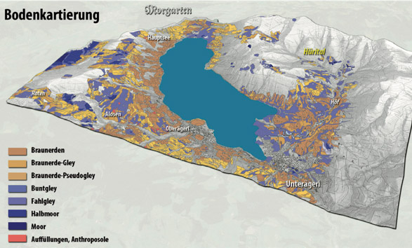
Bodentypen rund um den Ägerisee (Egli, Maisch, Çöltekin, Purves, 2015)
-
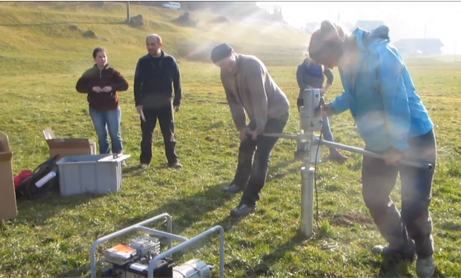
Entnahme von Moorproben am Morgarten (Screenshot Video)
Die Schlacht am Morgarten von 1315 wird zunehmend kontrovers diskutiert. Gemäss Chroniken wurde das Resultat der Schlacht entscheidend von der Landschaft geprägt: Die Eidgenossen bekämpften ihre zahlenmässig überlegenen Feinde angeblich von einem steilen Hang aus und die flüchtenden Habsburger ertranken im nahen Ägerisee. Allerdings finden sich in der heutigen Landschaft keine steilen Hänge direkt am See.
Aus Anlass des 700-jährigen Jubiläums der Schlacht am Morgarten 1315-2015 suchten Geographie-Studierende im Rahmen eines «Integrativen Projekts» Antworten auf die Fragen:
Sah die Landschaft um den Ägerisee damals anders aus?
Wo genau hat diese Schlacht überhaupt stattgefunden?
Publikation
Markus Egli, Max Maisch, Arzu Çöltekin, Ross Purves (Hrsg.): Mythos Morgarten aus geographischer Sicht. Geomorphologische, bodenkundliche und archäologische Spurensuche im ehemaligen Schlachtgebiet von 1315 (PDF, 36 MB). Schriftenreihe Physische Geographie 2015
Videos
Impressionen der Feldarbeiten
Digitaler Rundflug um Morgarten
Landschaft am Aegerisee: Eine Übersicht
Landschaftsanalyse am Morgarten
Weitere Informationen
GEO 401 Integratives Projekt FS/HS 2014
Die Schlacht am Morgarten (1315): Rekonstruktion und Visualisierung der Landschaft über die letzten Jahrhunderte