#112: "The Eyes Have It!" - Where we look while navigating
How do you navigate to a place you have never been to before? Do you look for clues in the environment, or do you follow the blue dot on your navigation system? Landmarks help us to learn the layout of a traveled space. In my Ph.D. project, I investigate how we should visualize landmarks on mobile map displays to support pedestrians in learning the environment they travel through.
We navigate to work, to shop, to recreate, day by day. Navigation and wayfinding, especially in unfamiliar environments, is a complex and cognitively challenging process. Landmarks help us to improve spatial learning by easing object identification between a map display and the environment. However, current navigation systems either omit landmarks or depict them using their spatial footprints and not how they are seen by wayfinders.
Real-world navigation study
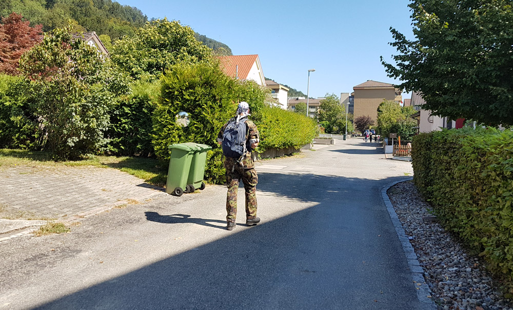
We conducted a real-world navigation study with genuine wayfinding experts - namely Swiss military personnel. We investigated whether different landmark visualization styles could help these navigators to learn a traveled space. The study was conducted in a residential area, unfamiliar to participants, in Brugg, Aargau, Switzerland. We asked our participants to follow a given route and to identify specific landmarks.
We developed two mobile map applications where landmarks are visualized as 2D abstract footprints in one and 3D realistic models in the other. We assigned participants to either the 2D or 3D map display group. At the end of the experiment, participants' spatial learning was examined with a spatial learning test. During the experiment, we used a mobile eye-tracker to record participants' eye-movements while solving a route following navigation task.
-
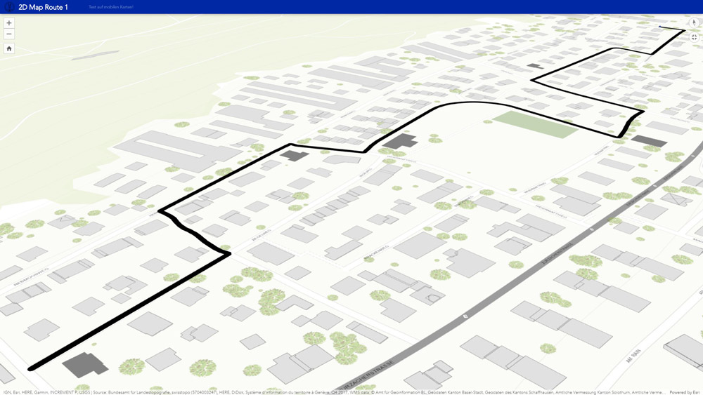
Landmarks visualized as 2D abstract footprints on the interactive map application.
-
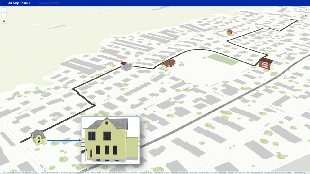
Landmarks visualized as 3D realistic models on the interactive map application.
What do we look at during navigation?
Navigators who were using a map with 2D landmark footprints spent more time looking at the environment and the navigation system, compared to the navigators using a mobile map with realistic looking 3D landmarks. However, the latter spent more time looking at the visualized landmarks.
How do we look at landmarks on a mobile map?
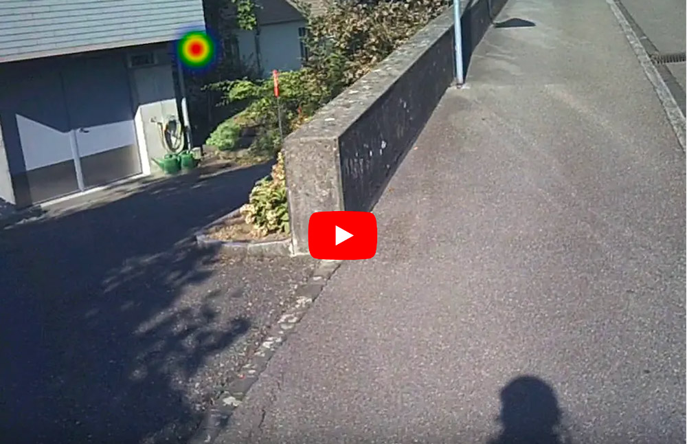
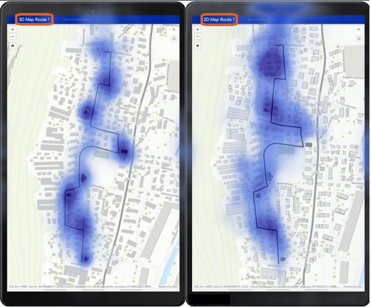
3D realistic landmarks draw more attention compared to the 2D footprints. The figure below shows the density of navigators' eye fixations on the map display recorded during the navigated route with the help of realistic looking 3D landmarks (left) compared to the 2D footprints (right). Users viewing 2D landmarks searched a wider area around the traveled route to obtain the necessary information to complete the navigation task.
Visual attention influences spatial learning
The participants who were looking at the environment more often improved their spatial learning significantly. However, the participants that looked more at the navigation system display exhibited worse spatial knowledge of the crossed environment.
The take-home message of our research is that the way users interact with the navigational devices affects their spatial learning of the traveled environment. People will continue to use these devices to ease their navigation needs. Thus, our findings have important implications for designing future navigation systems that focus on landmarks and direct pedestrians' attention back to the environment for improved spatial learning.