#5: Landkarten im Reduit
Ernstfall 1940: Bei einem Überfall der Wehrmacht hätten die Schweizer Karten vernichtet werden müssen.
-
- Karte der Schweiz 1929
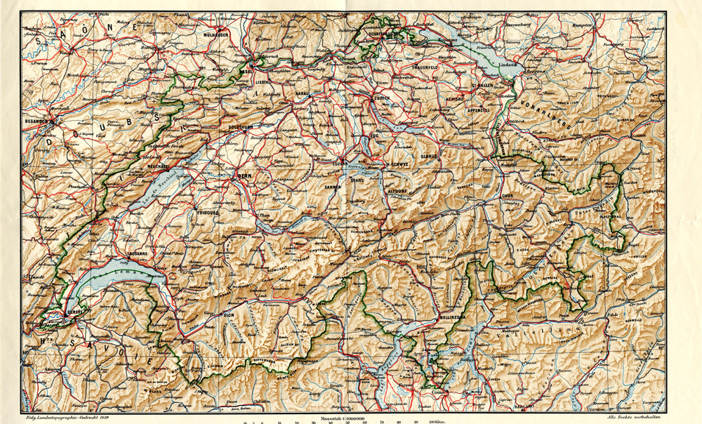
Am 15. Mai 1940, fünf Tage nach dem Überfall der deutschen Wehrmacht auf die Beneluxstaaten, erliess die Eidgenössische Landestopographie die Weisung, dass im Fall einer feindlichen Invasion geografische Karten und Atlanten der Schweiz vernichtet werden müssen, um sie einer Nutzung durch den Feind zu entziehen. Dies konnte entweder durch Verbrennung, durch Versenken in einem Gewässer oder durch Übergiessen mit Säure geschehen. Diese Weisung hatte Konsequenzen für das Geographische Institut der Universität Zürich, das über eine umfangreiche Sammlung topografischer Karten von beachtlichem wissenschaftlichem Wert verfügte.
Für die allfällige Vernichtung dieser Sammlung beschloss der damalige Rektor Paul Niggli, während des Sommers einen Heizkessel im Hauptgebäude, wo sich das Geographische Institut damals befand, in ständiger Bereitschaft zu halten und die Karten in dessen Nähe zu deponieren. Der entsprechend instruierte Hauswart könnte bei Kriegsausbruch sofort das Feuer anzünden und das Material verbrennen.
Die Vorstellung, dass die Kartensammlung vernichtet werden könnte, bereitete Otto Flückiger, dem stellvertretenden Direktor des Instituts, grosse Sorgen. Er wandte sich am 24. Mai in einem Schreiben an Rektor Niggli und schlug diesem vor, dass er die Karten statt in den Heizungskeller des Hauptgebäudes in eine entlegene Landschaft im Gebirge bringen würde. Es stehe ihm zu diesem Zweck – von einer ihm bekannten Persönlichkeit – eine Alphütte zur Verfügung. Die Karten wären dort sowohl gegen einen feindlichen Zugriff wie auch gegen Beschädigungen etwa durch Nässe geschützt.
Aus den überlieferten Unterlagen ist leider nicht ersichtlich, ob auf Flückigers Vorschlag eingegangen und die Kartensammlung in Sicherheit gebracht wurde. Auf jeden Fall hat die Sammlung die Kriegszeit unbeschadet überstanden. Zu Standortwechseln kam es lediglich im Zusammenhang mit den verschiedenen Umzügen des Geographischen Instituts nach seinem Auszug aus dem Hauptgebäude im Jahr 1954. Seit 1983 befindet sich das Institut auf dem Campus Irchel. Die Kartensammlung ist über den Lesesaal der Institutsbibliothek zugänglich.
More news
- #125: The 125th and last
- #124: Gletscher vor 125 Jahren und heute
- #123: Ist das Navi in der Hand der erste Schritt zum betreuten Wohnen?
- #122: Catapulted into a new world
- #121: How to make health care service provision more equitable and greener
- #120: Our world is a multidimensional collage
- #119: Is Tourism the Beginning or the End? Livelihoods of Georgian Mountain People at Stake
- #118: «Wir müssen den Klimawandel systematisch als Risiko mitdenken»
- #117: Andean mountain regions: Fragile sentinels of landscape and cultural transformation
- #116: Temporary streams at the doorsteps of Irchel Campus
- #115: Counting snowflakes from space
- #114: Provokation und Revolte am GIUZ
- #113: Ambitious goals for biodiversity urgently needed!
- #112: "The Eyes Have It!" - Where we look while navigating
- #111: Investigating plants genetic structure from above
- #110: «I see and I remember. I do and I understand.»
- #109: «Für uns, unsere Kinder und Kindeskinder»
- #108: Was macht die Digitalisierung mit unserer Umwelt?
- #107: The role of a developer at GIUZ
- #106: Dem unterirdischen Wasser auf der Spur
- #105: Was der Geographieunterricht zur Bildung im 21. Jahrhundert beitragen kann
- #104: Nepal - Kein Land für alte Leute?
- #103: Klimawandel in der Schweiz: Alles, was du wissen musst!
- #102: Wie Instagram unseren Umgang mit der Natur verändert
- #101: Numbed by navigation technologies: How can we counteract?
- #100: This is blog post number 100
- #99: Investigating food sustainability: from production and trade to consumption
- #98: Geographers live in concert - postponed!
- #97: Global Glyphosate: Uneven Geographies of herbicide production and use
- #96: "Pesticides burned grass and know-how"
- #95: Vier Standorte in 125 Jahren
- #94: Dietikon: Vom Bauerndorf zur Stadt
- #93: What is biodiversity?
- #92: Fieldwork in rural Nepal: reflection on positionality, responsibility, and roles
- #91: Das Schulfach Geographie: heute und morgen
- #90: Mapping functional diversity from space
- #89: Adieu ewig’ Eis
- #88: Landschaftsleistungen erlebbar machen
- #87: What is the role of variability in nature?
- #86: The Skin of Chitwan
- #85: Animated flight line collection over Switzerland
- #84: Space, Nature & Society: Wo wir forschen und was wir tun
- #83: Do you know about the 3MT competition?
- #82: An academic career in ecology
- #81: Hundreds of students enrich the start of the semester at the University of Zurich
- #80: Wie bewegen wir uns in Zukunft fort?
- #79: Willkommen im GEO- und ESS-Studium!
- #78: Expeditions from the window: How do you perceive your surroundings?
- #77: Researching a pandemic - during a pandemic
- #76: Das Geoteam stellt sich vor
- #75: How roots influence climate change
- #74: Imaging the earth from above
- #73: Studierende sammeln Daten: Natur, Landschaft und Ressourcen
- #72: Trouvaillen aus dem Archiv
- #71: The fluorescence of phytoplankton from 800 km above
- #70: Der kalte Norden ist auch familiär
- #69: How the COVID-19 pandemic is teaching us to tackle the climate crisis
- #68: Studierende sammeln Daten: Migration, Mobilität und Stadt
- #67: Summer break!
- #66: On the art of failing forward
- #65: Die Wasserstadt Zürich mit dem Smartphone entdecken
- #64: Tracing the tracks of the first Swiss polar explorers
- #63: Geistreiche Wortspiele
- #62: Von Gemüse über Milch bis zu Kaffee: Solawis in der Deutschschweiz
- #61: Berner Seeland - quo vadis?
- #60: Intense days on the field course to Val Piora
- #59: Panta rhei - everything flows
- #58: Comic Strip Geographies
- #57: Where we come from
- #56: A journey through time with loess deposits
- #55: Schlacht am Morgarten 1315: Wie sah die Landschaft damals aus?
- #54: Berne going green
- #53: Biochar increases rice root architecture
- #52: Cycling and pedestrian travel in Covid-19 world
- #51: The impact of Covid-19 from an economic geography perspective
- #50: Why do we create virtual forests?
- #49: Wenn das Eis fehlt: Das Lötschental und seine Zukunft
- #48: Planning ski tours: insights from Big Data
- #47: Is there a place for people in protected areas?
- #46: Biodiversity in Irchel park
- #45: Cress, tomatoes and the meaning of the universe
- #44: Scientific games to understand social-ecological system dynamics
- #43: Insight into the WGMS
- #42: Connecting female hydrologists worldwide: an initiative born at GIUZ
- #41: Shopping with Maximilian
- #40: Sars-CoV-2 and food producers: who cares?
- #39: The value of water
- #38: Mit Slimy-Masse die Gletscherschmelze illustrieren
- #37: Was machen Geographinnen und Geographen nach dem Studium?
- #36: Geographie-Student Jonathan, der Erdball und die CO2-Männli
- #35: Two study programs at the Department of Geography
- #34: Urban Sustainability as New Financial Fix?
- #33: Silently in the background
- #32: Interaktiv und interdisziplinär
- #31: Unpacking the complexity of social-ecological systems
- #30: Listen to the landscape
- #29: Creating synergies between homeschooling and university teaching
- #28: The first fully remote PhD defenses
- #27: Der Weltwassertag fällt ins Wasser
- #26: The GIUZ Sustainability Task Force
- #25: What is geography?
- #24: «Geografe nüme schlafe!»
- #23: Zurich on its way to the 2000-Watt society
- #22: Spatial genetics for plant-based communities - and much more!
- #21: Strebergärtli - Irchel Garden Project
- #20: Writing papers - a nightmare. Or not?
- #19: Urbanised landscapes - living between nature and civilisation
- #18: A 3D view on breathing forests
- #17: «Wir sind hier, wir sind laut!»
- #16: What is EGEA?
- #15: Exploring the future of biodiversity
- #14: Avalanche bulletins in the Alps: consistency across borders
- #13: Ice age coffee
- #12: Greenland 1912 - and today!
- #11: «Wir sitzen alle im selben Boot»
- #10: Air miles monitoring & reduction @ GIUZ
- #9: The "Geographie Alumni UZH" society: a platform for people interested in Geography
- #8: Knowledge in images - information design today
- #7: Geographie in Aufruhr
- #6: Glacier measurement series with mayonnaise
- #4: Mapping the plastic soup
- #3: New unit "Space, Nature and Society"
- #2: How it all began
- #1: Happy 125th Anniversary