#71: The fluorescence of phytoplankton from 800 km above
How do you monitor micrometer-sized marine phytoplankton using data from a satellite located 800 km above the Earth's surface? In a field campaign in Tyrrhenian Sea, researchers from RSWS, CNR and ENEA, and Scripps Institute of Oceanography demonstrated how it works.
-
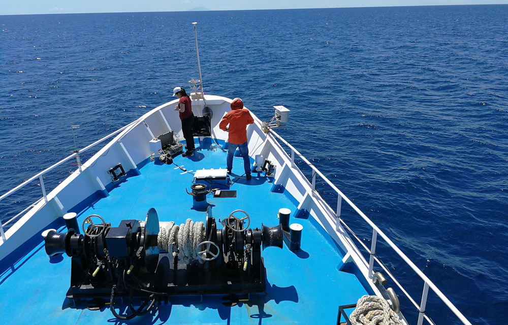
Obtaining measurements at the deck (Photo: Luca Fiorani)
-
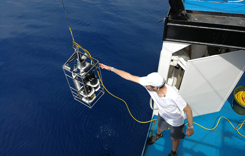
Preparing to deploy the water profiler (Photo: Luca Fiorani)
-
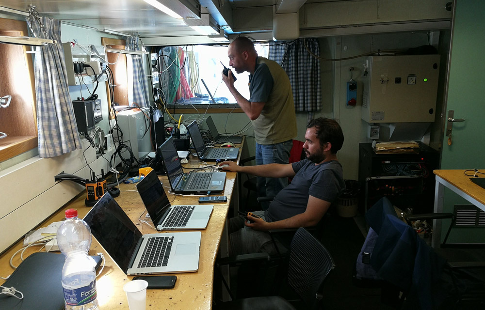
Makeshift office space and coordination room (Photo: Luca Fiorani)
-
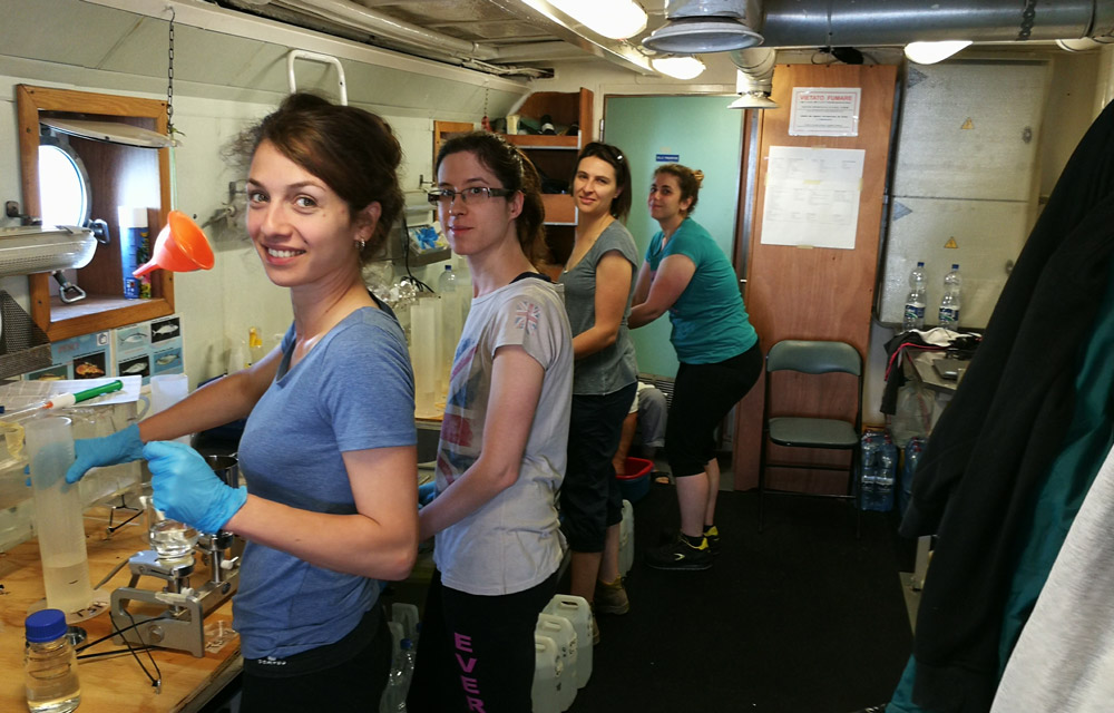
Ship's laboratory area where water samples were filtered (Photo: L. Fiorani)
Sun-induced fluorescence (SIF) can be retrieved not only from plants and trees but also from phytoplankton in lakes and coastal areas. It is an important indicator of phytoplankton biomass and physiological status and will give us further insights on trophic status and primary productivity in aquatic environments.
Several research groups and institutes across Europe were involved in the FLEXSense campaign organized by the European Space Agency (ESA) in summer of 2018 to conduct measurements and experiments as part of the preparation of the upcoming Earth Explorer satellite mission Fluorescence Explorer (FLEX).
The field(sea)work experience
We took part in a coastal ecosystem research cruise where we obtained in-situ data concurrently with airborne (Hyplant) and spaceborne (Sentinel-3 OLCI) measurements. Aboard the Dallaporta research ship from CNR, and after overcoming seasickness, we sampled and measured at different points in the Tyrrhenian Sea using different radiometers, water profilers and probes. The ship was always buzzing with excitement during these measurement periods and it was great to witness experienced oceanographers in their element firsthand. We also had ample time to relax between sampling points and in the evening where everyone gathered to enjoy great Italian meals.
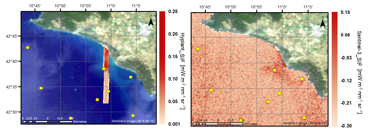
Estimating phytoplankton fluorescence from satellite data
Using a simple empirical algorithm, we were able to see similar SIF trends from in-situ, airborne and spaceborne measurements. In general and as expected, we see a increasing trend in SIF as we move towards the coast. We also observed the influence of the Ombrone River delta to the coastal area, increasing the SIF estimated near the river mouth perhaps due to the nutrients carried by the river discharge. First insights gathered during this campaign will facilitate our future research activities that aim to develop advanced SIF retrieval schemes for aquatic environments and to ultimately exploit SIF as robust indicator of phytoplankton diversity and productivity.