Navigation auf uzh.ch
Navigation auf uzh.ch
This list of ongoing and completed Ph.D. projects gives an impression of some of the research that is carried out by our graduate students. Responsible advisors are shown in brackets.
Zingaro Donatella
Modelling geographic relevance in the digital era
(Reichenbacher / Fabrikant / Schöning / Purves)
Muratori Corrado
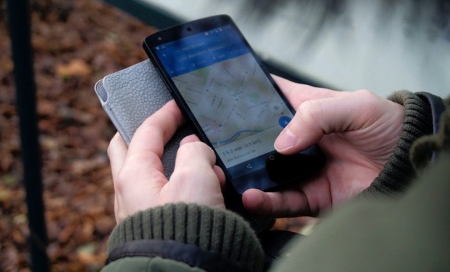
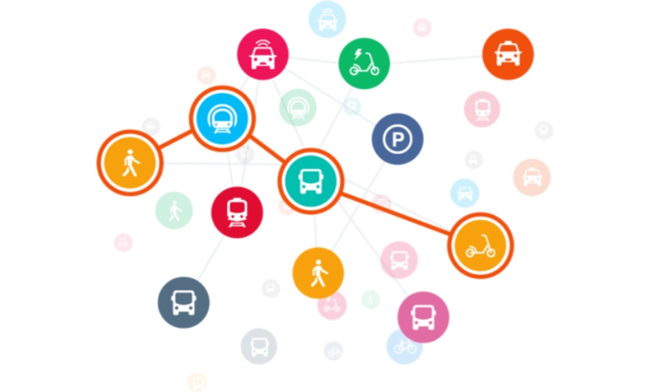
Sustainable mobility through optimal linking of multimodal solutions
(Fabrikant, Wüst, Bütikofer, Del Duce)
Qi Ying
From Maps in the Head to Maps in the Hand: Towards Familiarity-adaptive Mobile Navigation Systems
(Fabrikant, Santos, Hilton)
If not available below, PDFs of Ph.D. theses can be found in the library catalog of the University of Zurich.
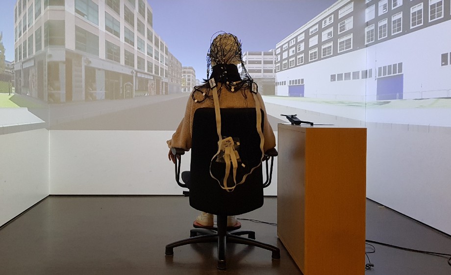
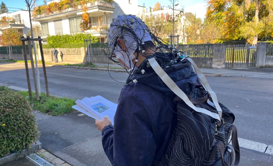
Cheng Bingjie
Human spatial navigation in the digital era—effects of landmark depiction on mobile maps on navigators’ spatial learning and cognitive load during assisted navigation
(Fabrikant / Gramann / Weibel)
PDF (PDF, 3 MB)
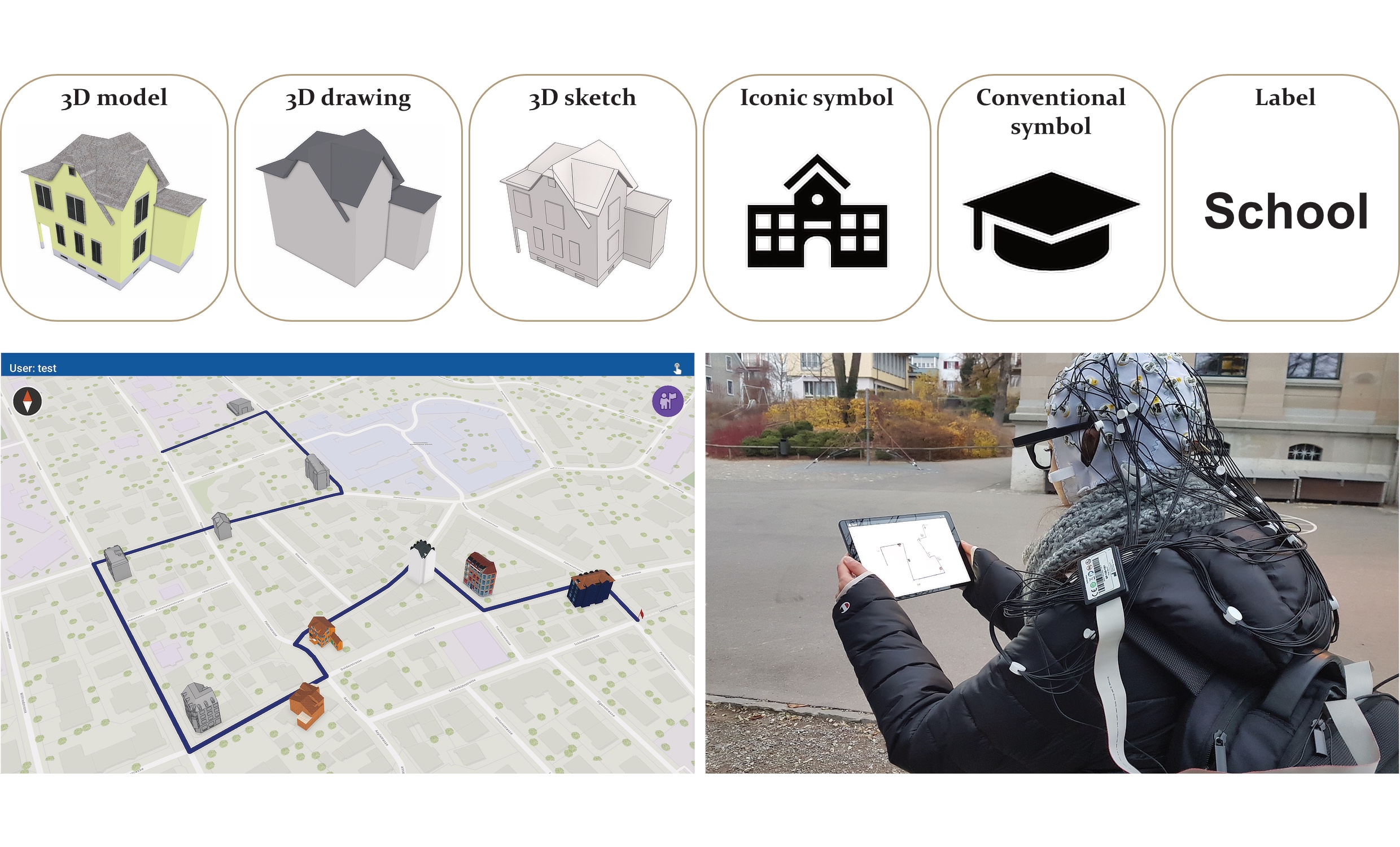
Kapaj Armand
Landmark Visualization on Mobile Maps – Effects on Visual Attention, Spatial Learning, and Cognitive Load during Map-Aided Real-World Navigation of Pedestrians
(Fabrikant / Gartner / Lanini-Maggi / Richter / Weibel)
PDF (PDF, 41 MB)
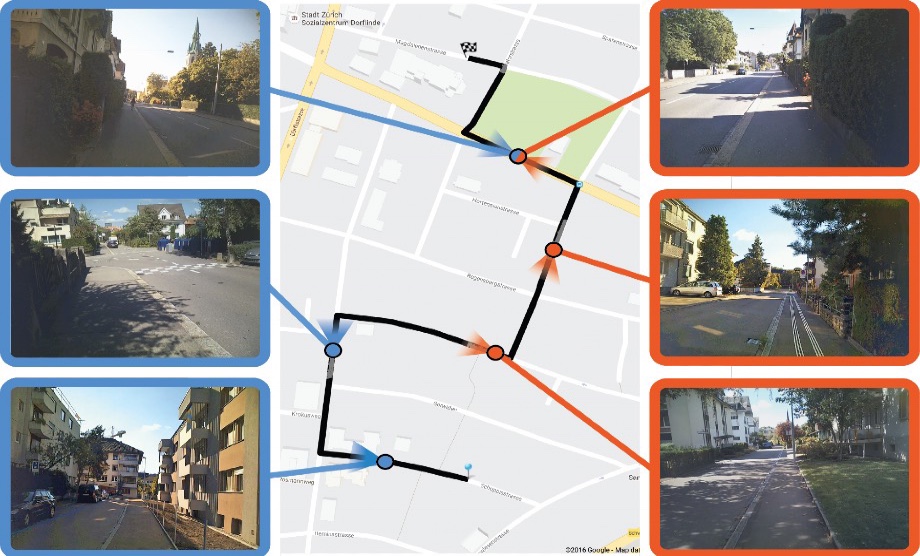
Brügger Annina
Walk and Learn: Effects of Human-Centered Navigation Systems on Pedestrians’ Navigation Behavior
(Richter / Fabrikant / Weibel)
PDF (PDF, 57 MB)
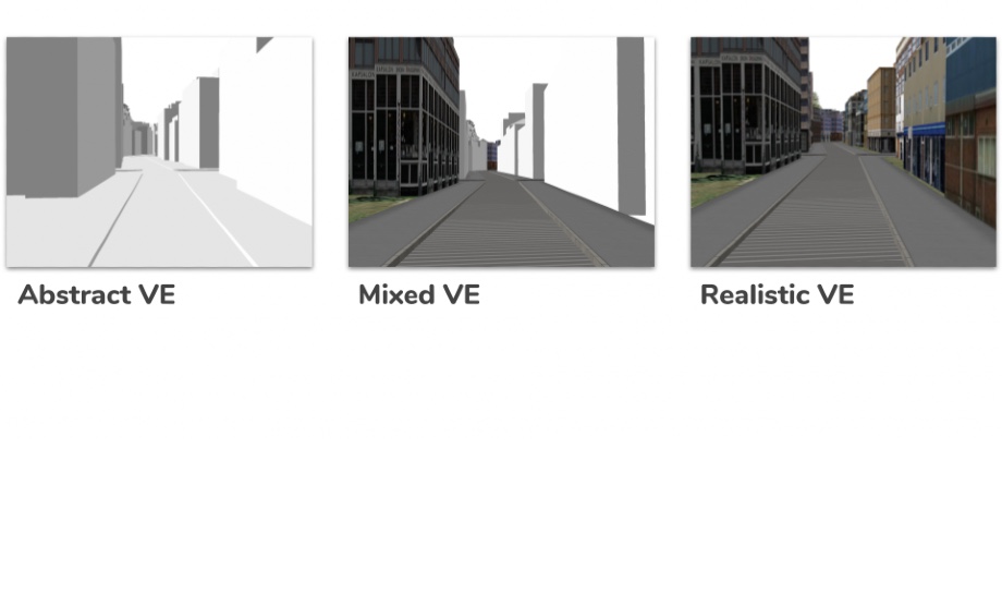
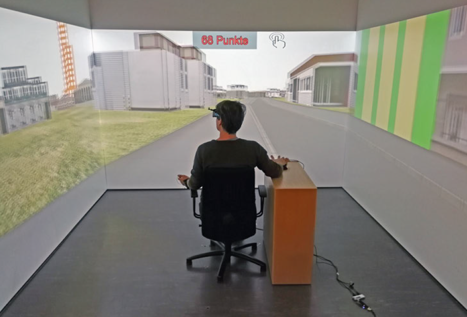
Lokka Ismini-Eleni
The Impact of 3D Virtual Environments with Different Levels of Realism on Route Learning: A Focus on Age-Based Differences
(Çöltekin / Fabrikant / Weibel / Wiener)
PDF (PDF, 9 MB)
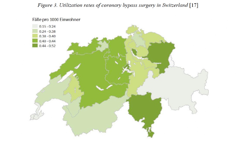
Wei Wenjia
Regional Variation and Influencing Factors in the Utilization of Diverse Healthcare Services: a Comprehensive Analysis Approach (von Wyl, Schwenkglenks, Dressel, Grübner, Fabrikant)
PDF (PDF, 5 MB)
Rothacher Yannick
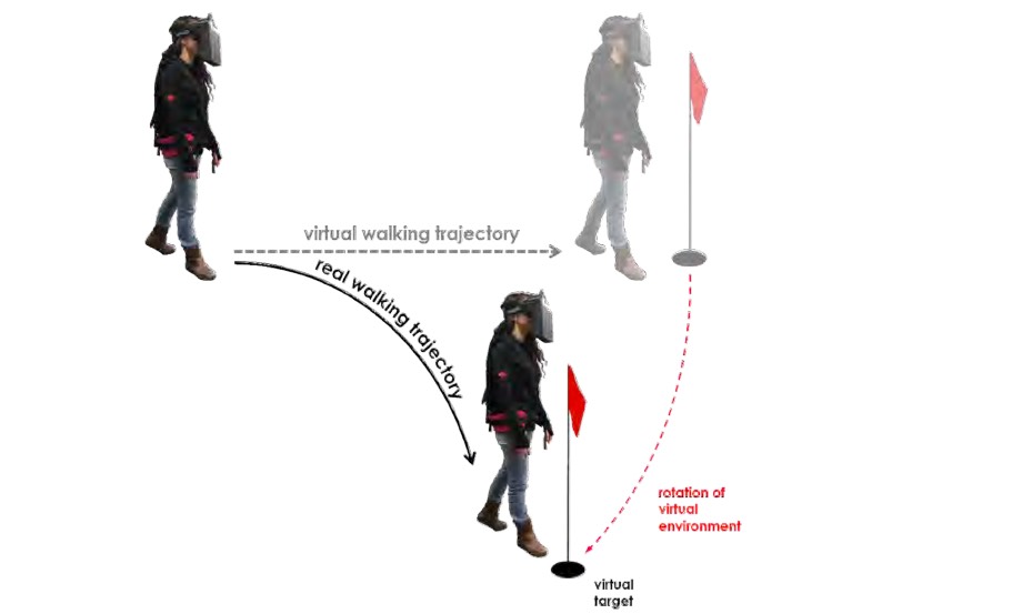
Neuropsychological Aspects of Redirected Walking in Virtual Reality
(Jäncke, Brugger, Kunz, Fabrikant)
PDF (PDF, 6 MB)
Sascha Credé
The Benefits of Global Landmarks for Spatial Learning under Stress
(Fabrikant / Christen / Hölscher / Weibel)
PDF (PDF, 3 MB)
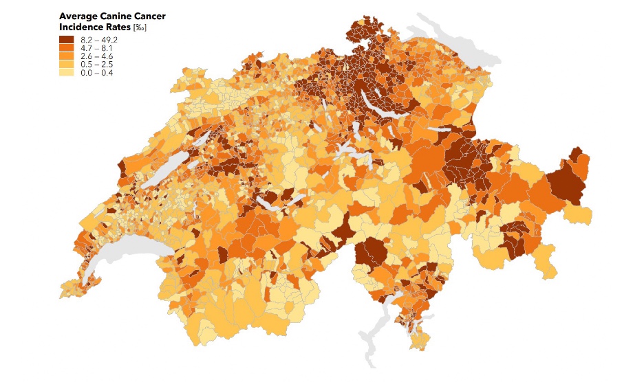
Gianluca Boo
Space-Time Analysis of Tumor Incidence: Companion Animals as Public Health Sentinels
(Fabrikant / Axhausen / Pospischil / Leyk)
PDF (PDF, 9 MB)
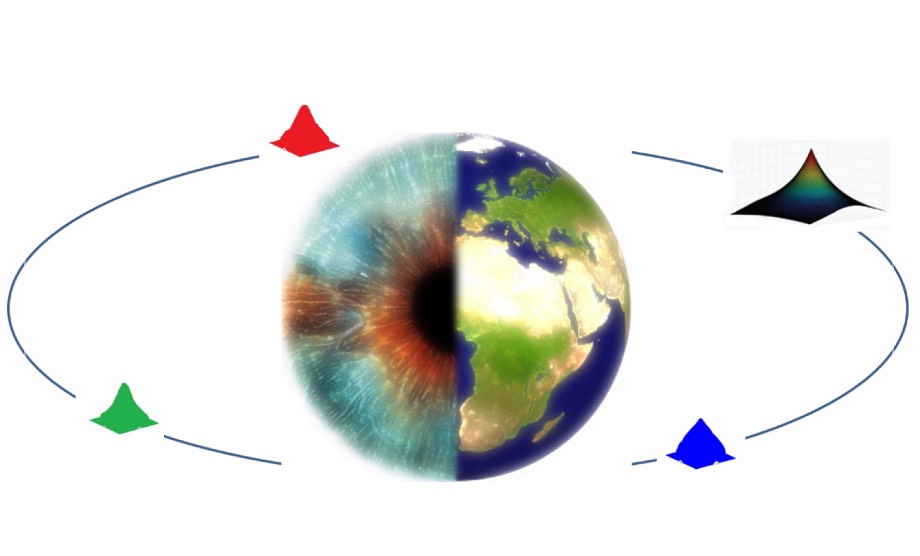
Kenan Bektas
Gaze Contingent Geovisualization for Level of Detail Management
(Coltekin / Fabrikant)
Link
Sara Lanini-Maggi
Depicting Movement Data with Animations for Embodied and Real-Time Decision-Making: A User Study with Air Traffic Control Displays and Real-Time Movement Data
(Fabrikant)
PDF (PDF, 6 MB)
André Bruggmann
Visualization and Interactive Exploration of Spatio-Temporal and Thematic Information in Digital Text Archives
(Fabrikant)
PDF (PDF, 9 MB)
Stefano De Sabbata
Assessing Geographic Relevance for Mobile Information Services
(Reichenbacher / Fabrikant / Purves / Schlieder)
PDF (PDF, 8 MB)
Jan Wilkening
The Effect Of Time Pressure On Map-Based Decision Making
(Fabrikant / Reichenbacher / Montello)
PDF (PDF, 2 MB)
Anna-Katharina Lautenschütz
Assessing the Relevance of Context for Visualizations of Movement Trajectories
(Fabrikant / Hegarty / Reichenbacher / Weibel)
PDF (PDF, 16 MB)
Heidi Kaspar
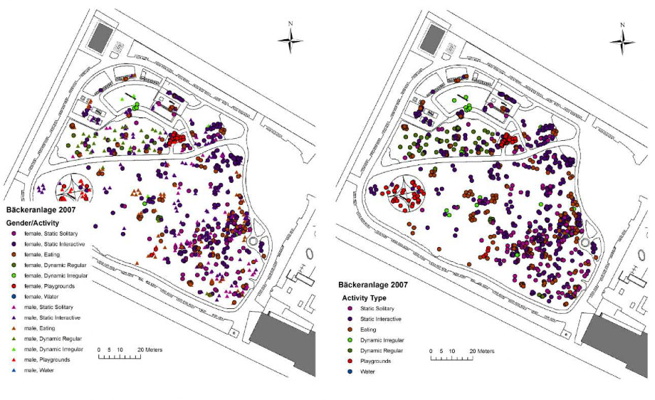
Erlebnis Stadtpark: Alltägliche Raumkonstruktionen am Beispiel städtischer Grünräume
(Fabrikant, Berndt, Elsasser, Timpf)
PDF (PDF, 6 MB)
Frank Ostermann
Modeling, Analyzing, and Visualizing Human Space Appropriation
(Timpf / Bühler / Elsasser)
PDF (PDF, 8 MB)
David Caduff
Assessing Landmark Salience for Navigation
(Fabrikant / Timpf)
PDF (PDF, 16 MB)
Urs-Jakob Rüetschi
Wayfinding in Scene Space: Modelling Transfers in Public Transport
(Timpf / Fabrikant)
PDF (PDF, 1 MB)
Michael Hermann
Werte, Wandel und Raum. Theoretische Grundlagen und empirische Evidenzen zum Wandel regionaler Mentalitäten in der Schweiz
(Prof. K. Brassel / Prof. H. Elsasser)
PDF (PDF, 4 MB)
Charis Lengen
Swiss Health Space : an explorative analysis of health perception and its relationship to socio-demographic and geographic characteristics
(Prof. S. Fabrikant / Prof. U. Müller-Böker / Prof. K. Brassel)
PDF (PDF, 17 MB)
Heiri Leuthold Baumann
Die sozialräumliche Dynamik der urbanisierten Schweiz und ihre politikgeografische Dimension
(Prof. K. Brassel / Prof. H. Elsasser)
Farshad Hakimpour
Using Ontologies to Resolve Semantic Heterogeneity for Integrating Spatial Database Schemata
(Prof. Dr. K. Brassel / Prof. Dr. K. Dittrich / Dr. S. Timpf)
Mattias Bader
Energy Minimizing Methods for Feature Displacement in Map Generalization
(Prof. Dr. R. Weibel / Prof. K. Brassel / Prof. M. Sester, University of Hannover)
Stephan Imfeld
Time, Points and Space - towards a better Analysis of Wildlife Data in GIS
(Prof. K. Brassel / Dr. B. Allgöwer / Prof. B. Nievergelt, Institute of Zoology, Prof. P. Fisher, University of Leicester)
Rainer Zah
Sources and Pathways of organic matter and energy in an alpine stream ecosystem
(Prof. J. Ward and Dr. U. Uehlinger, EAWAG / Prof. K Brassel)
Felix Bucher
Regionenbasierte Wahl und Parametrisierung von Interpolationsmodellen
(Prof. Dr. K. Brassel / Prof. R. Weibel)
Geoffrey Dutton
Working Through the Scales -- A Hierarchical Coordinate System for Digital Map Data (Prof. R. Weibel / Prof. K. Brassel / Prof. G. Gensler, SMA)
Bernhard Schneider
Geomorphologisch plausible Rekonstruktion der digitalen Repräsentation von Geländeoberflächen aus Höhenliniendaten
(Prof. R. Weibel / Prof. Dr. K. Brassel)
Caroline Westort
Methods for Sculpting Digital Topographic Surfaces
(Prof. R. Weibel / Prof. K. Brassel / Prof. S. Ervin, Harvard University)
Walter Bosshard
Homogenisierung klimatologischer Zeitreihen, dargelegt am Beispiel der relativen Sonnenscheindauer 1997
(Prof. K. Brassel / Dr. Gisler and Dr. W. Kirchhofer, SMA)
Martin Brändli
Modelle und Methoden für die Extraktion geomorphologischer und hydrologischer Objekte aus digitalen Geländemodellen
(Prof. Dr. K. Brassel / Prof. R. Weibel)
Eva Lippert-Stephan
Exploratory visualization in environmental data analysis 1997
(Prof. K. Brassel / Prof. P. Stucki, IFI)
Andrej Vckovski
Interoperable and Distributed Geoprocessing
(Prof. Dr. K. Brassel / Prof. R. Weibel)
Hans Rudolf Bär
Interaktive Bearbeitung von Geländeoberflächen - Konzepte, Methoden, Versuche
(Prof. Dr. K. Brassel)
René Sieber
Visuelle Wahrnehmung dreidimensionaler parametrisierter Objekte und Objektgruppen. Eine empirische Unterschung zur Bestimmung eines optimalen Betrachterstandortes
(Prof. K. Brassel / Prof. H. Kishimoto)
Brigitte Bisig
Regionale Unterschiede von Strassenverkehrsunfällen in der Schweiz - eine quantitative Analyse als Basis für kantonale Unfallpräventionsstrategien 1994
(Prof. K. Brassel / Prof. F. Gutzwiler, ISPM)
Urban Schertenleib
Kartographie in Winterthur. Beiträge der Winterthurer Kartographie-Betriebe zur Methodengeschichte der Kartographie des 19. Jahrhunderts
(Prof. K. Brassel / Prof. A. Dürst)
Ruedi Boesch
Modellierung von Niederschlagsverlagerungen im Radarbild
(Prof. K. Brassel)
Adrian Herzog
Die Polygonfilterung als Methode zur automatischen Generalisierung von statistischen Oberflächen
(Prof. K. Brassel)
André de Montmollin
Comparisaisons de differentes methodes de calcul de la temperatuare journaliere dans leurs influences sur les longues series d'observation
(Prof. K. Brassel / Prof. G. Gensler, SMA)
Otto Simonett
Geographic Information Systems for Environment and Development
(Prof. K. Brassel / Prof. A. Leemann)
Matthias Bopp
Die Versorgungslage der Bevölkerung in der Agglomeration Zürich unter besonderer Berücksichtigung des Lebensmittel-Detailhandels
(Prof. K. Brassel / Prof. H. Elsasser)
Stefan Fassbind
Konzepte und Analysen zur Einrichtung eines Immissionsmessnetzes im Kanton Thurgau
(Prof. K. Brassel)
Robert Weibel
Konzepte und Experimente zur Automatisierung der Reliefgeneralisierung
(Prof. K. Brassel)
Karl H. Böhler
Geographische Aspekte zur Integration der Eisenbahn in die Landesverteidigung der Schweiz bis 1872
(Prof. K. Brassel / Prof. W. Schaufelberger, ETHZ)
Peter Jud
Elisée Reclus und Charles Perron, Schöpfer der "Nouvelle Géographie Universelle". Ein Beitrag zur Wissenschaftshistorie des 19. Jahrhunderts
(Prof. K. Brassel / Prof. G. Furrer / Prof. A. Dürst)