4D Remote Sensing of Forests

Overview
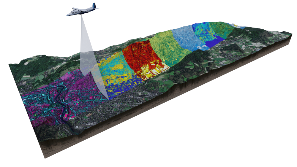
Our research group is focused on developing and applying remote sensing technologies to monitor and analyse forest ecosystems. This includes the use of LiDAR (Light Detection and Ranging) and other remote sensing tools to gather data on forest structure, biomass, and health. We develop innovative, physically-based methods for extracting detailed information from multi-scale remote sensing data, contributing to our understanding of forest dynamics, biodiversity, and carbon cycling. Additionally, we use radiative transfer models to deepen our knowledge of the fundamentals of remote sensing within the challenging 4D environment of forests.
Team
- Bornand, Aline
- Helfenstein, Isabelle
- Koch, Tiziana
- Kükenbrink, Daniel
- Morsdorf, Felix (Group leader)
Publications
ZORA Publication List
Download Options
Publications
-
Correcting crown-level clumping effect for improving leaf area index retrieval from large-footprint LiDAR: A study based on the simulated waveform and GLAS data. IEEE Journal of Selected Topics in Applied Earth Observations and Remote Sensing, 14:12386-12402.
-
Modelling of three-dimensional, diurnal light extinction in two contrasting forests. Agricultural and Forest Meteorology, 296:108230.
-
Mapping functional diversity using individual tree-based morphological and physiological traits in a subtropical forest. Remote Sensing of Environment, 252:112170.
-
Standardizing ecosystem morphological traits from 3D information sources. Trends in Ecology & Evolution, 35(8):656-667.
-
Remote sensing of forest gas exchange: considerations derived from a tomographic perspective. Global Change Biology, 26(4):2717-2727.
-
The Laegeren site: an augmented forest laboratory combining 3-D reconstruction and radiative transfer models for trait-based assessment of functional diversity. In: Cavender-Bares, Jeannine; Gamon, John A; Townsend, Philip A. Remote sensing of plant biodiversity. Cham (Switzerland): Springer, 83-104.
-
Tree species classification in a temperate mixed forest using a combination of imaging spectroscopy and airborne laser scanning. Agricultural and Forest Meteorology, 279:107744.
-
Mapping the irradiance field of a single tree: quantifying vegetation-induced adjacency effects. IEEE Transactions on Geoscience and Remote Sensing, 57(7):4994-5011.
-
Synergies of spaceborne imaging spectroscopy with other remote sensing approaches. Surveys in Geophysics, 40(3):657-687.
-
Quantifying 3D structure and occlusion in dense tropical and temperate forests using close-range LiDAR. Agricultural and Forest Meteorology, 268:249-257.
-
Remote sensing of plant-water relations: An overview and future perspectives. Journal of Plant Physiology, 227:3-19.
-
Close-range laser scanning in forests: towards physically based semantics across scales. Interface Focus, 8(2):2017.0046.
-
3D dynamics of debris flows quantified at sub-second intervals from laser profiles. Natural Hazard, 89(2):785-800.
-
UAV-based LiDAR acquisition for the derivation of high-resolution forest and ground information. The Leading Edge, 36(7):566-570.
-
Mapping functional diversity from remotely sensed morphological and physiological forest traits. Nature Communications, 8(1):1441.
-
Retrieval of higher order statistical moments from full-waveform LiDAR data for tree species classification. Remote Sensing of Environment, 196:28-41.
-
Quantification of hidden canopy volume of airborne laser scanning data using a voxel traversal algorithm. Remote Sensing of Environment, 194:424-436.
-
International benchmarking of the individual tree detection methods for modeling 3-D canopy structure for silviculture and forest ecology using airborne laser scanning. IEEE Transactions on Geoscience and Remote Sensing, 54(9):5011-5027.
-
Single tree identification using airborne multibaseline SAR interferometry data. Remote Sensing of Environment, 186:567-580.