4D Remote Sensing of Forests
Overview
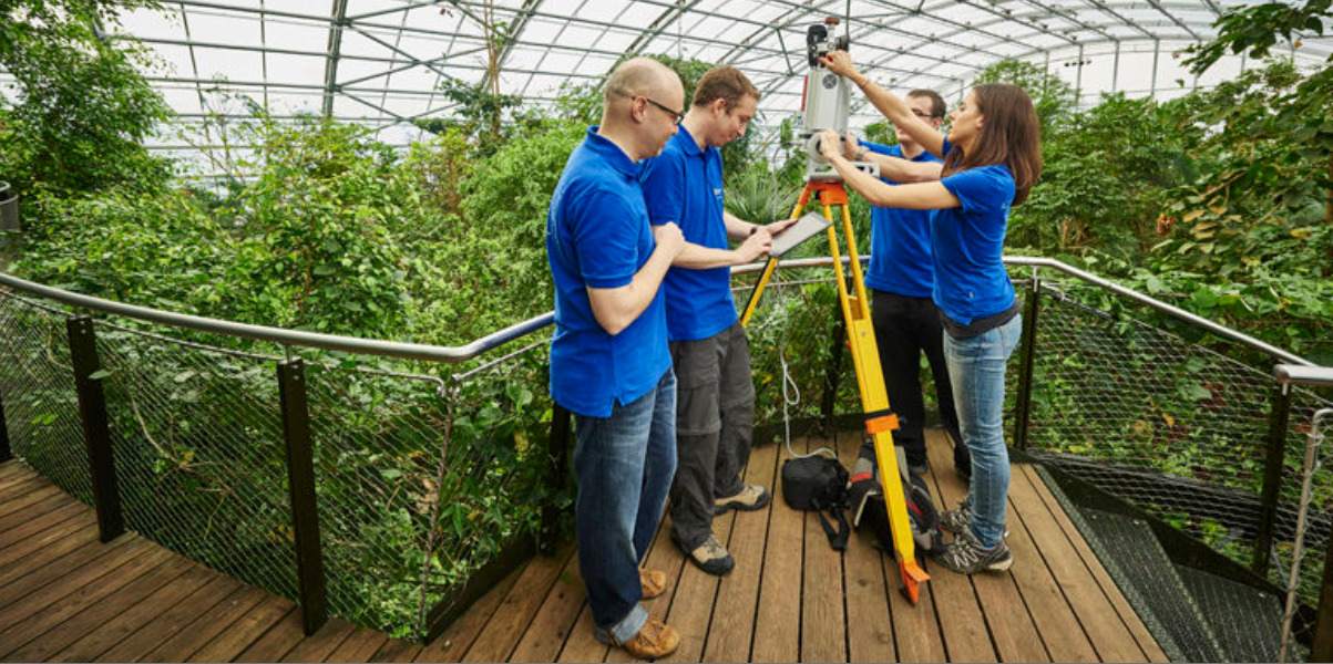
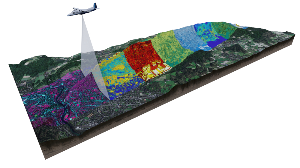
Our research group is focused on developing and applying remote sensing technologies to monitor and analyse forest ecosystems. This includes the use of LiDAR (Light Detection and Ranging) and other remote sensing tools to gather data on forest structure, biomass, and health. We develop innovative, physically-based methods for extracting detailed information from multi-scale remote sensing data, contributing to our understanding of forest dynamics, biodiversity, and carbon cycling. Additionally, we use radiative transfer models to deepen our knowledge of the fundamentals of remote sensing within the challenging 4D environment of forests.
Team
- Bornand, Aline
- Helfenstein, Isabelle
- Koch, Tiziana
- Kükenbrink, Daniel
- Morsdorf, Felix (Group leader)
Publications
ZORA Publication List
Download Options
Publications
-
A role for airborne laser scanning data in vertical stratification of multilayered ecosystems. In: Bretar, F. Laser scanning 2009. Enschede, the Netherlands: ISPRS, 141-146.
-
Assessing forest structural and physiological information content of multi-spectral LiDAR waveforms by radiative transfer modelling. Remote Sensing of Environment, 113(10):2152-2163.
-
Tomographic imaging of a forested area by airborne multi-baseline P-Band SAR. Sensors, 8(9):5884-5896.
-
Modelling multi-spectral LIDAR vegetation backscatter – assessing structural and physiological information content. In: Silvilaser 2008: 8th international conference on LiDAR applications in forest assessment and inventory, Edinburgh, UK, 17 September 2008 - 19 September 2008, 257-265.
-
Multi-source land cover classification for forest fire management based on imaging spectrometry and LiDAR data. Forest Ecology and Management, 256(3):263-271.
-
Assessment of the influence of flying altitude and scan angle on biophysical vegetation products derived from airborne laser scanning. International Journal of Remote Sensing, 29(5):1387-1406.
-
Ray tracing for modeling of small footprint airborne laser scanning returns. In: ISPRS Workshop 'Laser Scanning 2007 and SilviLaser 2007', Espoo (SF), 12 September 2007 - 14 September 2007, 294-299.
-
Fusion of imaging spectrometer LIDAR data using support vector machines for land cover classification. In: ISPRS Working Group VII/1 Workshop ISPMSRS'07: "Physical Measurements and Signatures in Remote Sensing", Davos (CH), 12 March 2007 - 14 March 2007, 297-301.
-
Forest canopy gap fraction from terrestrial laser scanning. Geoscience and Remote Sensing Letters, 4(1):157-160.
-
Fusion of imaging spectrometer and LIDAR data over combined radiative transfer models for forest canopy characterization. Remote Sensing of Environment, 106(4):449-459.
-
Inversion of combined radiative transfer models for imaging spectrometer and LIDAR data. In: IGARSS 2006, Denver CO, 31 July 2006 - 4 August 2006. IEEE Xplore, 395-398.
-
Assessment on the influence of flying height and scan angle on biophysical vegetation products derived from airborne laser scanning. In: International Workshop 3D Remote Sensing in Forestry, Wien (A), 14 February 2006 - 15 February 2006, 145-150.
-
Three-dimensional forest canopy structure from terrestrial laser scanning. In: International Workshop 3D Remote Sensing in Forestry, Wien (A), 14 February 2006 - 15 February 2006, 50-54.
-
Long-term fire history and high-resolution remote sensing based fuel assessment: Key elements for fire and landscape management in nature conservation areas. Forest Ecology and Management, 234:S212.
-
Estimation of LAI and fractional cover from small footprint airborne laser scanning data based on gap fraction. Remote Sensing of Environment, 104(1):50-61.
-
Inversion of a lidar waveform model for forest biophysical parameter estimation. Geoscience and Remote Sensing Letters, 3(1):49-53.
-
LIDAR remote sensing for estimation of biophysical vegetation parameters. 2006, University of Zurich, Faculty of Science.
-
Assessment of canopy structure and heterogeneity from multi-angular CHRIS-PROBA data. In: 9th international symposium on Physical Measurements and Signatures in Remote Sensing (ISPMSRS), Beijing, China, 17 October 2005 - 19 October 2005, 76-78.
-
Concept for forest parameter estimation based on combined Imaging Spectrometer and LIDAR data. In: 4th EARsel workshop on Imaging Spectroscopy, Warsaw, Poland, 27 April 2005 - 30 April 2005, 593-603.
-
Combination of imaging spectrometer data and high-resolution LIDAR data by 3-D radiative transfer modeling. In: 13th Annual JPL Airborne Earth Science Workshop, Pasadena, CA, USA, 31 March 2004 - 2 April 2004, 151-156.