Synthetic Aperture Radar (SAR) imagery uses radar signals to generate high-resolution images of Earth's surface, regardless of weather or lighting conditions. By measuring the time and intensity of radar pulses reflected from the ground, SAR captures detailed information on terrain, structures, and changes over time, making it essential for applications like environmental monitoring, disaster response, and surveillance.
The SARLab (Computational SAR) at RSL focuses on the understanding of the entire data processing chain of airborne and drone-based synthetic aperture radar systems: from SAR campaign planning through raw data focusing, calibration and validation to value-adding products.
Mission statement: Gaining knowledge through high quality SAR images and products.
Drone SAR
Advancements in sensor technology have enabled the miniaturization of SAR systems, making them suitable for drones/UAVs. We focus on achieving optimal image quality and precise focusing with drone-mounted SAR systems. Additionally, we explore innovative applications where the flexibility and maneuverability of drone SAR offer significant advantages over traditional airborne and satellite platforms.


Multifrequency Polarimetric SAR
Polarimetric SAR (PolSAR) is a radar imaging technique that utilizes various polarization combinations (e.g. HH, HV, VH, VV) to examine how objects scatter electromagnetic waves. By configuring the transmitting and receiving antennas in multiple polarization modes, PolSAR can distinguish between different scattering mechanisms—such as even-bounce (from flat surfaces), odd-bounce (from vertical structures like buildings), and volume scattering (from vegetation).
QuadPolSAR: Enhanced Object Information: QuadPol helps in distinguishing between diverse land features, vegetation types, and man-made structures.
Multifrequency SAR: Multifrequency SAR utilizes multiple radar frequency bands to capture images of the same area, each band interacting uniquely with surface features. X-band provides high-resolution imagery but has limited penetration, making it well-suited for surface-level detail. C-band offers moderate penetration, balancing resolution and depth for versatile observations. L-band penetrates more deeply, ideal for exploring subsurface features and imaging through dense vegetation. By combining these frequencies, multifrequency SAR delivers a multi-layered view, enhancing our understanding of both surface and subsurface characteristics across diverse landscapes. Depth and Subsurface Analysis: different frequencies penetrate various depths. For example, X-band (short wavelength) primarily captures surface details, C-band penetrates vegetation moderately, and L-band (long wavelength) penetrates more deeply into the vegetation canopy and soil.
Here are some examples of images acquired with DLR's F-SAR sensor in 2019, Memmingen (Germany).
-

Pauli RGB Composite at X-band (R=HH-VV, G=HV+VH, B=HH+VV)
-

Pauli RGB Composite at C-band (R=HH-VV, G=HV+VH, B=HH+VV)
-

Pauli RGB Composite at L-band (R=HH-VV, G=HV+VH, B=HH+VV)
-
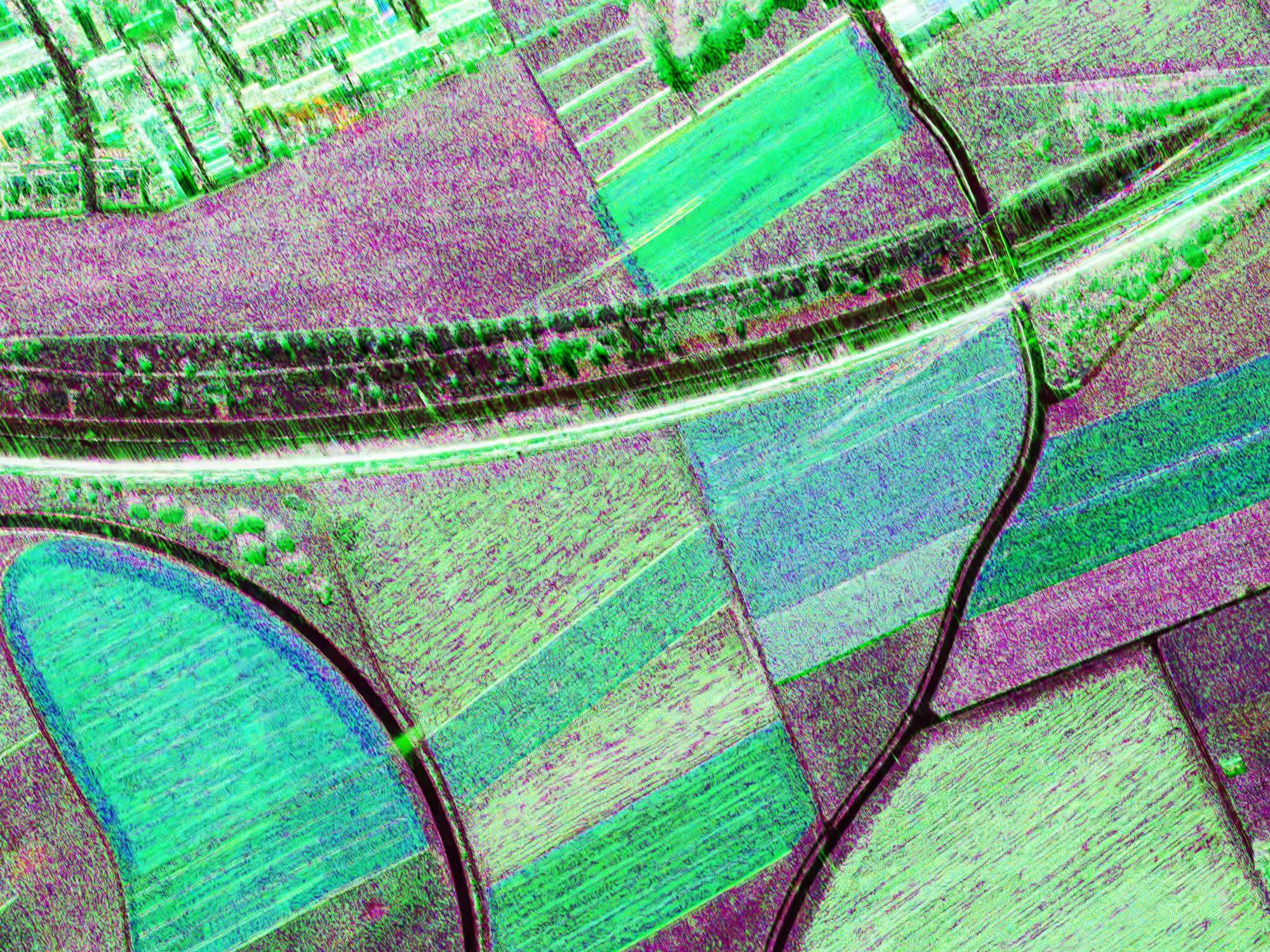
Multifrequency RGB Composite with the HH images (R=X-band HH, G=C-band HH, B=L-band HH)
-

Multifrequency Odd-Bounce Composite (R=HH+VV at X-band, G= HH+VV at C-band, B= HH+VV at L-band)
-

Multifrequency Volume Scattering Composite (R=HV+VH at X-band, G= HV+VH at C-band, B= HV+VH at L-band)
-

Multifrequency Even-Bounce Composite (R=HH-VV at X-band, G= HH-VV at C-band, B= HH-VV at L-band)
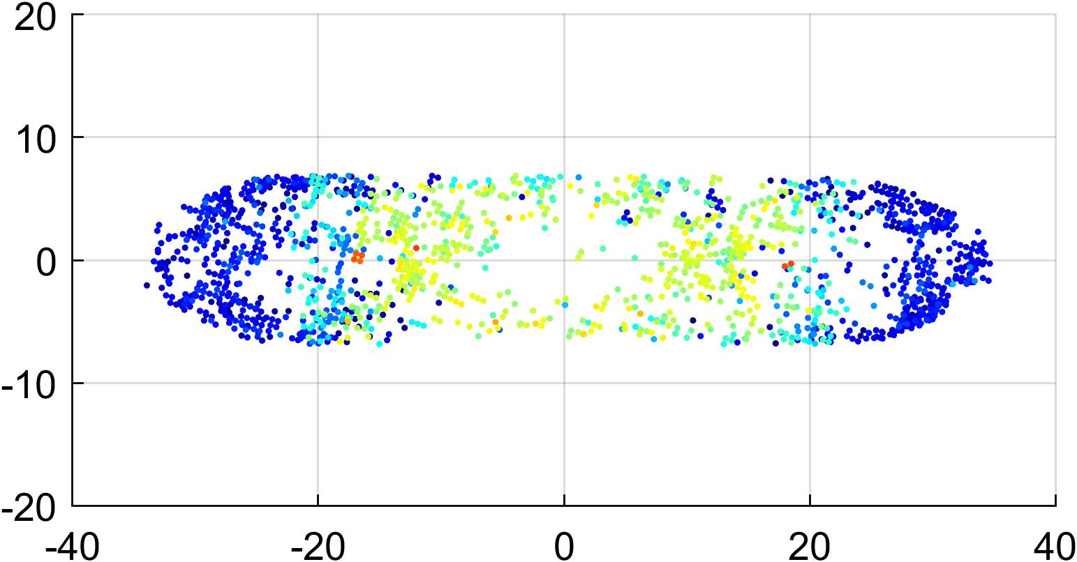
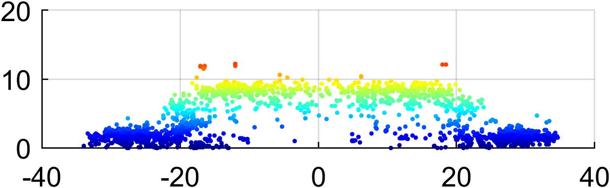
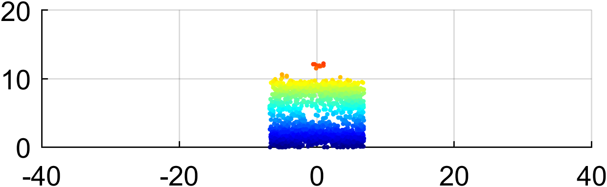
Ground Moving Target Indication (GMTI)
SAR-GMTI (Synthetic Aperture RADAR - Ground Moving Target Indication) is a RADAR technique used to detect moving targets within SAR images, which are typically designed to capture high-resolution ground imagery. The signature of a moving target (e.g., cars, trains, vessels) is usually blurred and displaced in position due to the relative motion between the SAR sensor and the target, which is not accounted for during traditional SAR focusing. Moving target refocusing techniques are designed to compensate for this relative motion, thereby "refocusing" the image to correct the blur and provide a clearer, high-resolution representation of the moving object.

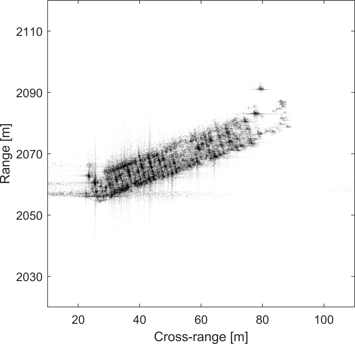
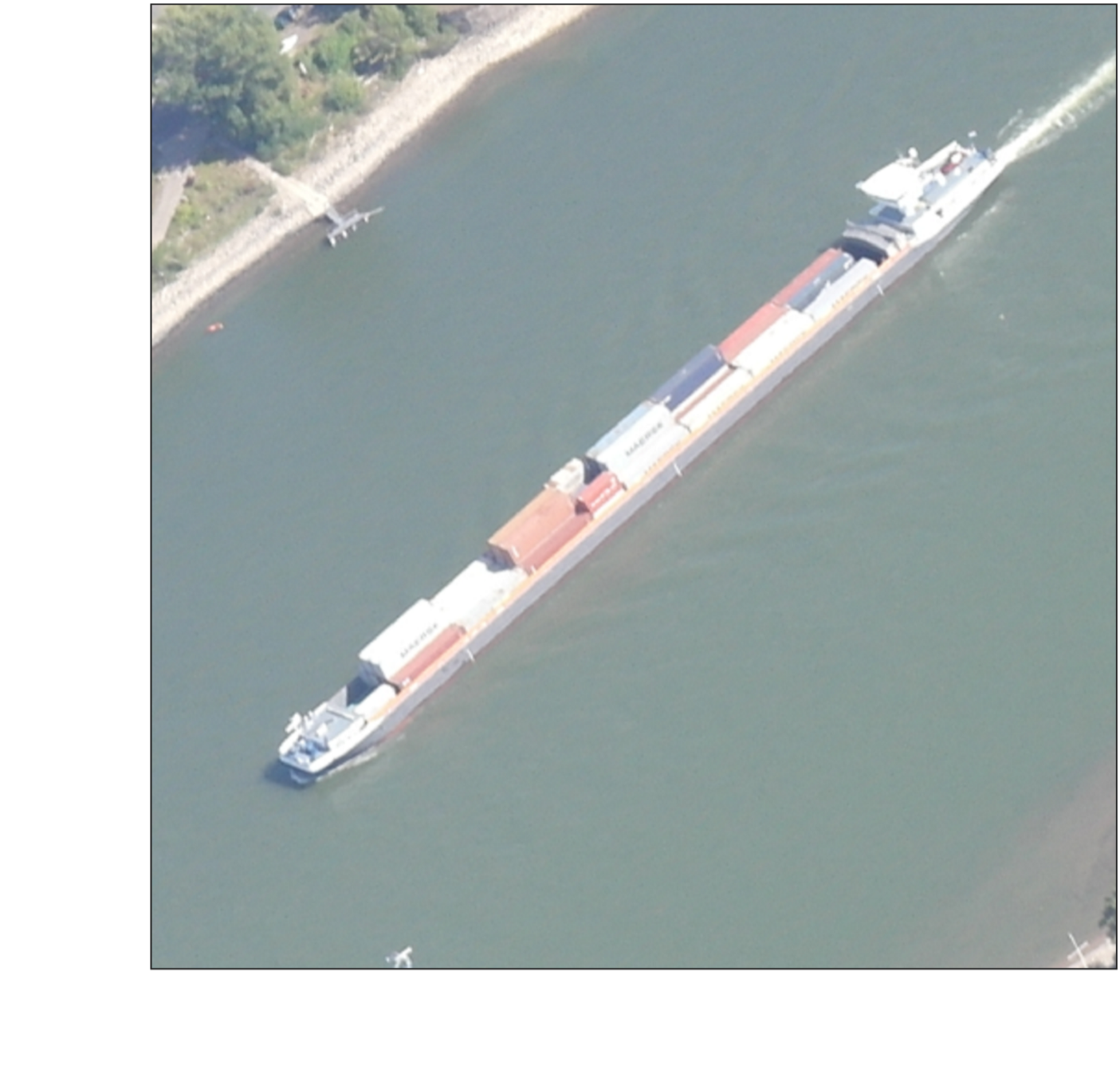

Furthermore, when multiple receiving channels are available, it is possible to further process the refocused images, merge their information, and derive a three-dimensional point cloud of the target under analysis.


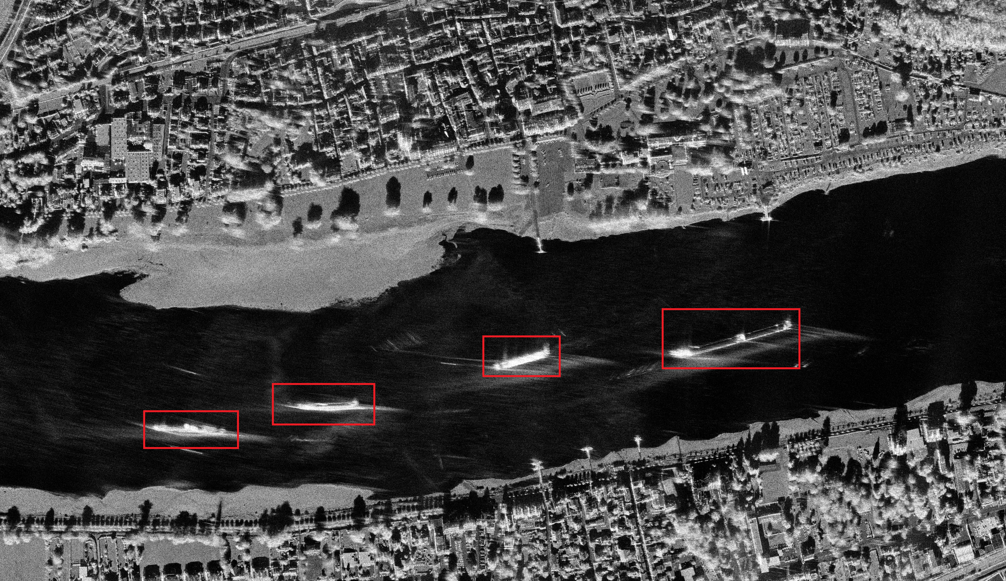
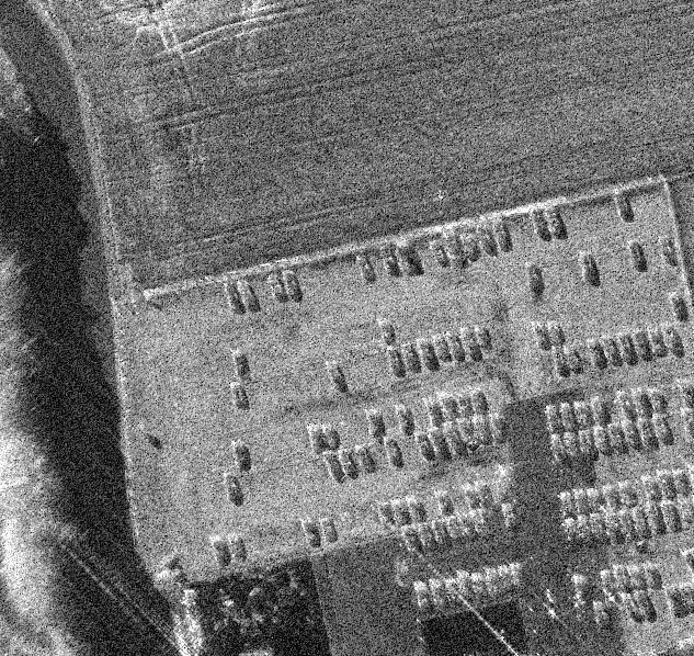
Vehicle Detection using AI
One application of SAR imagery is vehicle detection, which can significantly enhance surveillance capabilities. To achieve this, we trained a deep learning model to detect cars. Here are some of the results:


Group members
- Dr. Elías Méndez Domínguez (Senior scientist, lead: raw data focusing, tomographic SAR, change detection)
- Dr. Emiliano Casalini (PostDoc: ground moving target indication, inverse SAR)
- Peter Brotzer (PhD candidate: drone-based SAR, autofocus, navigation)
- Jérôme Bonvin (MSc student: Vehicle Detection using AI)
- Dr. Erich Meier (Affiliated scientist)
We welcome you to reach out to us anytime—don't hesitate to get in touch!