The tools we use
We work with multiple instruments and apply varying methodologies in our research.
This is an overview – reach out if you like to know more and exchange with us.
Instruments
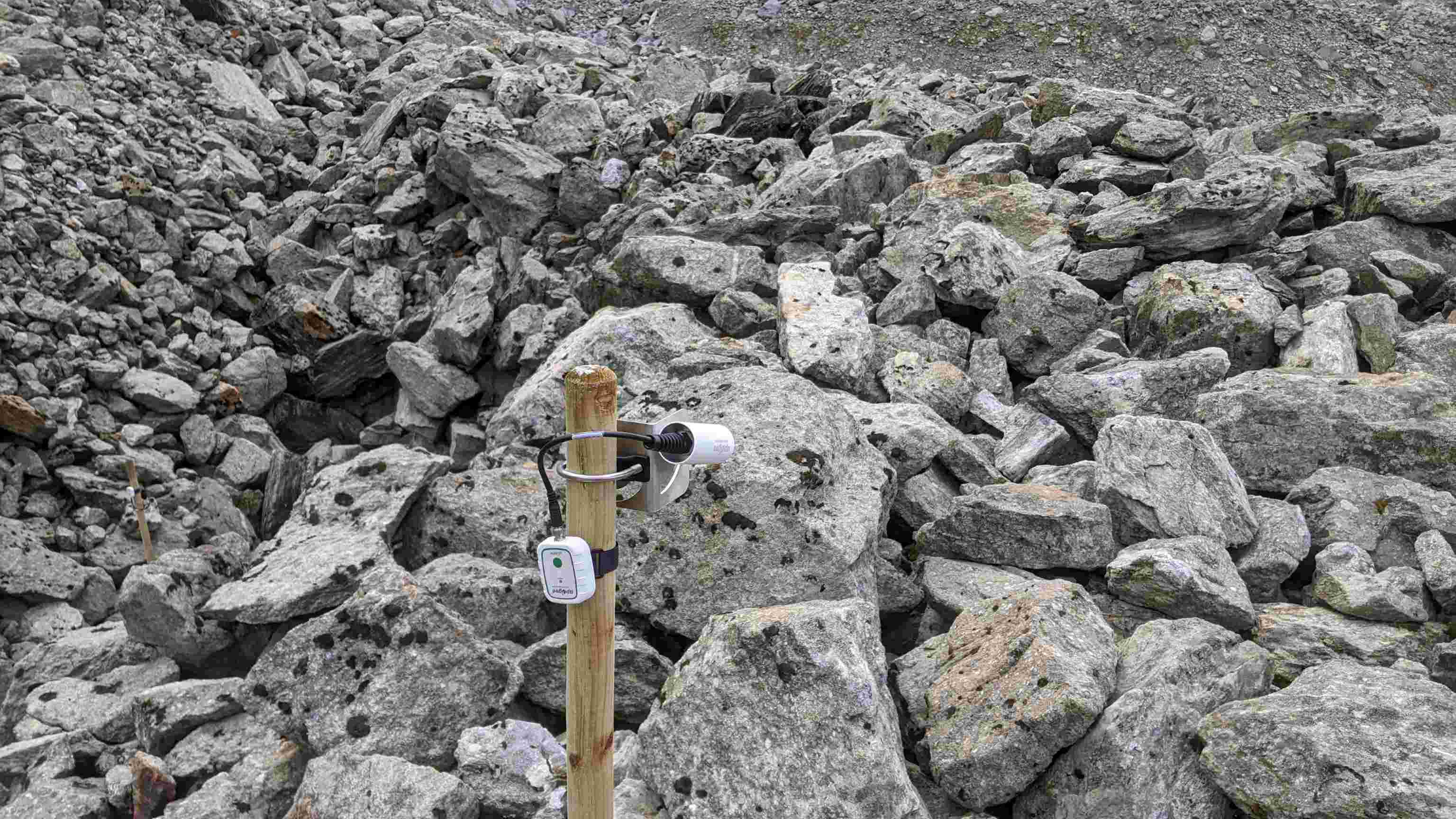
Broadband thermal infrared radiometers
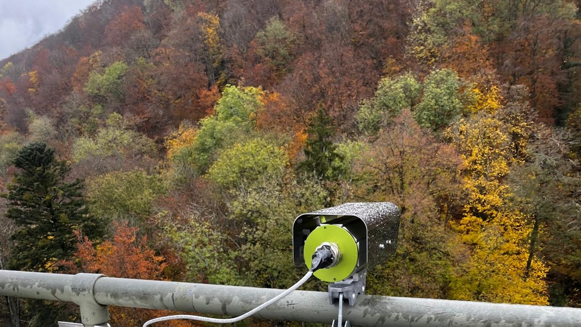
We make use of radiometers installed on the field to acquire continuous radiometric surface temperatures. We calibrate them with blackbodies in a controlled laboratory setting.
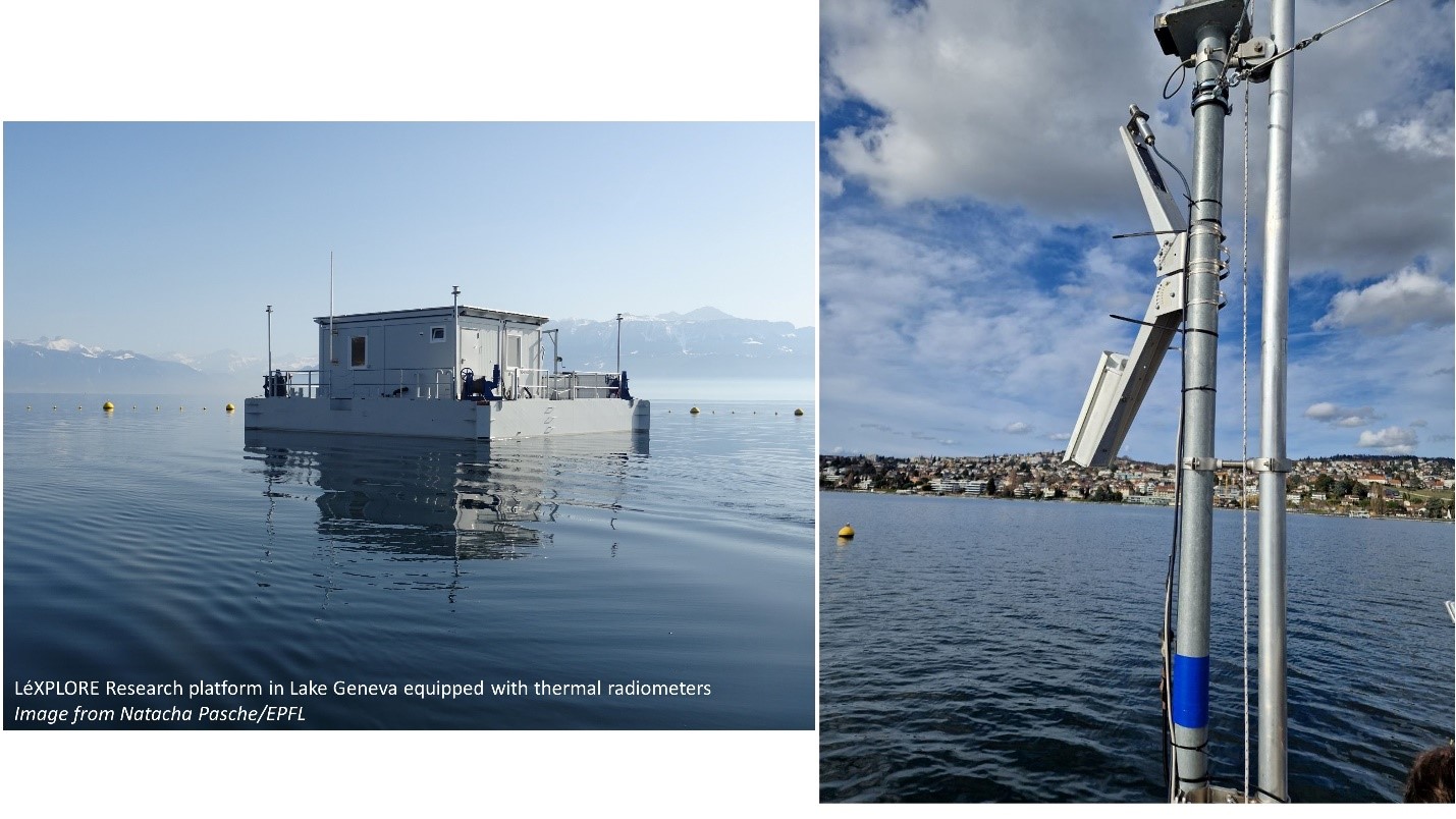
Heitronics thermal radiometers
Heitronics radiometers allow for very high precision water, canopy, and sky temperature measurements to provide stable long-term cal/val datasets for satellite products, as well as for accurate LST monitoring.
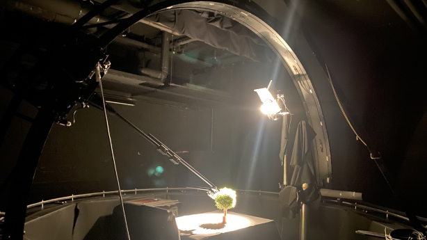
Goniometer laboratory experiments
By installing the TIR radiometer on our goniometer, we study temperature directionality effects in a controlled environment over artificial and real surfaces, such as micro-canopies.
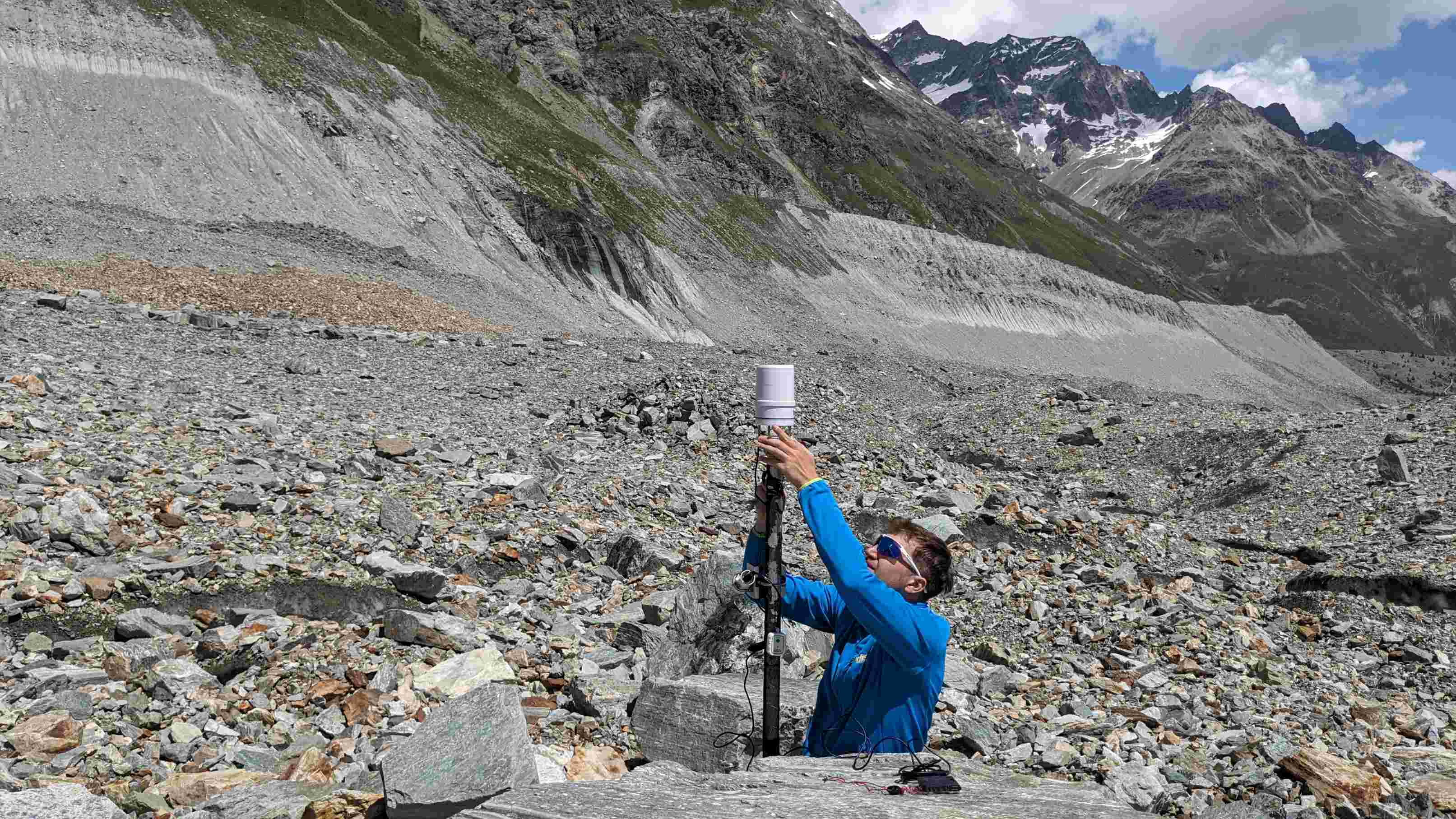
Meteorological data
We measure continuous meteorological data on most of our sites to have a record of the climatic conditions affecting our thermal observations.
Thermal imaging cameras
Our thermal imaging cameras allow to acquire accurate radiometric temperatures over forests at a very high temporal resolution.
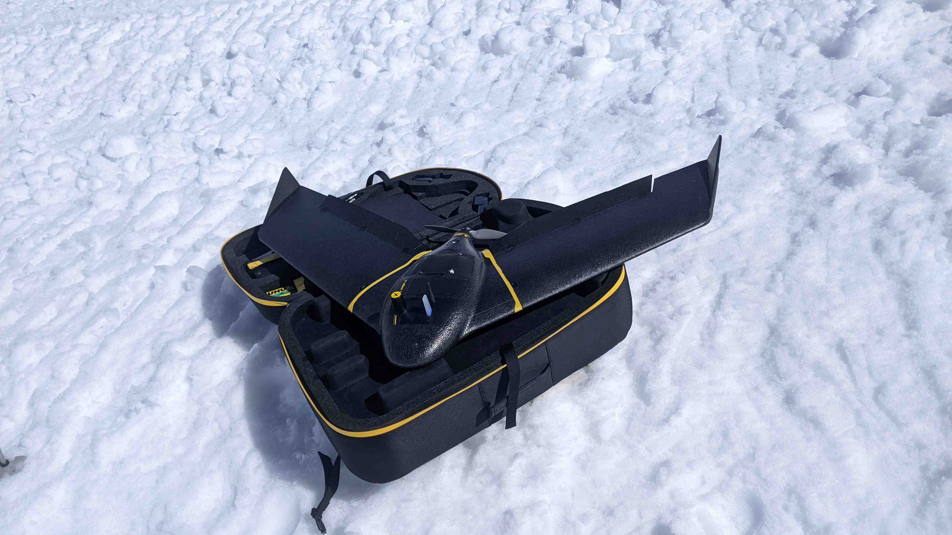
Optical, thermal and multispectral drone cameras
We make use of drone cameras to conduct high-resolution surveys. This requires a thorough characterisation of the cameras (especially for TIR) , as well as post-processing schemes and validation with in situ observations.
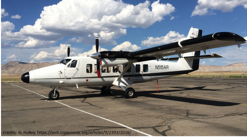
Airborne hyperspectral thermal observations
We make use of airborne Hyperspectral Thermal Infrared data from HyTES and TASI instruments, which feature 256 and 64 bands in the TIR domain, respectively, to study our sites at high spectral and spatial resolution.
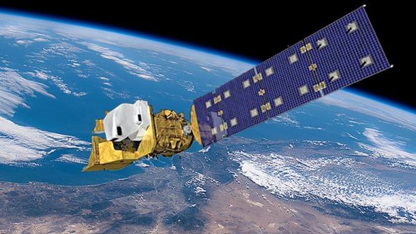
Satellite data
We use spaceborne TIR data to conduct large scale studies over the Arctic, Alpine lakes, debris-covered glaciers, and forests.
Methodologies
| Experiments | Observations | Modelling |
|
|