Mapping forests in complex terrain: When high-resolution data can be misleading
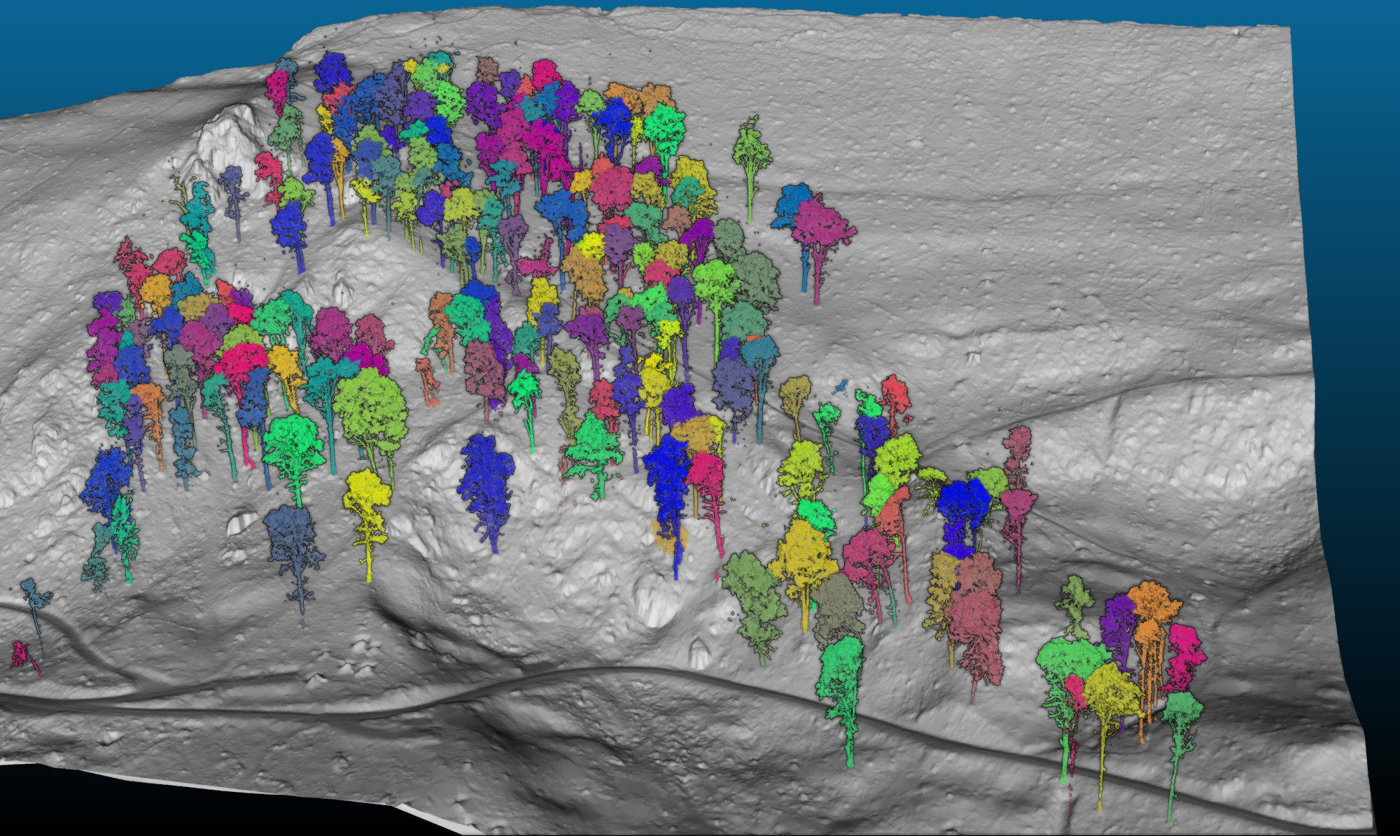
We combined precise tree-stem positions with 3D-derived crown outlines to analyse forest structure on steep slopes. A key insight: terrain matters. On slopes, tree crowns are often laterally displaced relative to their stems and are therefore not necessarily located vertically above them. Assuming vertical alignment can introduce systematic errors - especially in high-resolution aerial imagery where individual trees are resolved.
More about the method:
Felix Morsdorf, Mauro Marty, Daniel Kükenbrink: UAV-Based LiDAR and SfM-derived 3D Point Clouds of Forest Canopies – Observation Angles Matter
Dreiländertagung der DGPF, der OVG und der SGPF in Muttenz, Schweiz, 2025
More about the project:
Mapping the future of Laegern’s beech forest
GIUZ Blog, 25.03.2025
Image: Felix Morsdorf