Navigation auf uzh.ch
Navigation auf uzh.ch
Using machine learning and data enrichment in the selection of roads for small-scale maps Cartography and Geographic Information Science
Izabela Karsznia, Albert Adolf, Stefan Leyk and Robert Weibel
Abstract
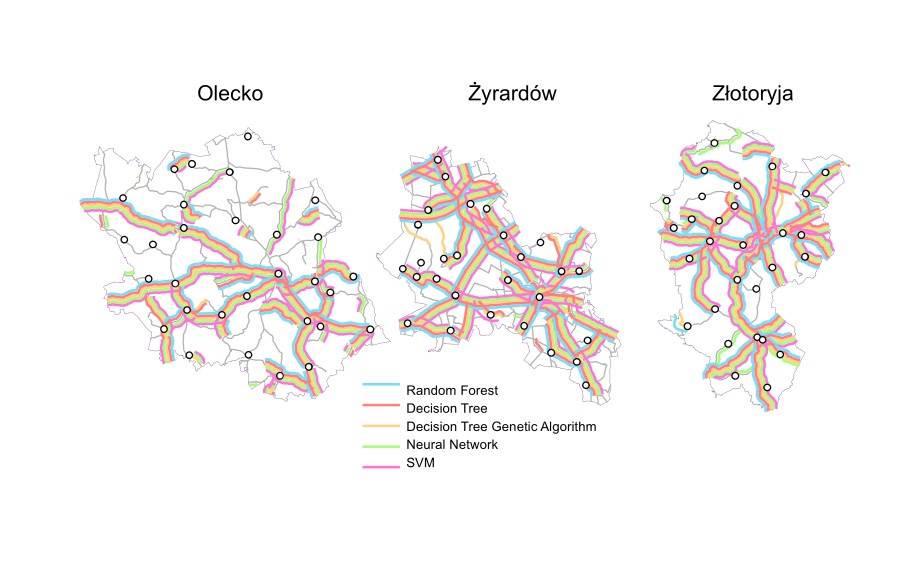
Making decisions about which objects to keep or omit is challenging in map design. This process, called selection, constitutes the first operation in cartographic generalization. In this research, a method of automatic road selection for creating small-scale maps using machine learning and data enrichment is proposed. First, the problem of contextual information scarcity concerning roads in the source database is addressed. Additional information concerning the relations between roads and other objects was added (such as centrality and proximity measures). Second, machine learning is used to design automatic selection models based on enriched information. Third, three different road selection approaches are implemented. The baseline approach is following the official map design guidelines. The second approach is based on machine learning using the enriched road database. The third approach is based on an existing structural model. The results of all approaches are compared to existing atlas maps designed by experienced cartographers. The results of the Machine Learning Approaches were most similar to the atlas maps (between 81% and 90% accuracy). The least efficient approaches were the Structural Approach with 32% and the Guidelines Approach with 44% accuracy. We conclude that enriching road data with new contextual information concerning roads and using machine learning is beneficial as the achieved results outperform both Guidelines and Structural Approaches.