 |
| HOME | PUBLICATIONS | CONTACT | LINKS |
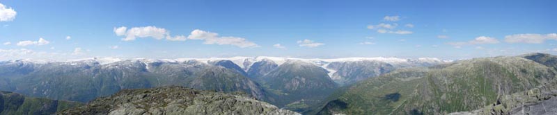
Reconciling geological and modelled reconstructions of Alpine glacier evolution from the Last Glacial Maximum into the HoloceneProject (Co-PI) funded by the Swiss National Science Foundation (grant 200020-213077), ongoing (2023–2026). Research summary
Quaternary glaciations have left numerous geological footprints in the landscape of the European Alps, especially during and after the Last Glacial Maximum (LGM). Despite extensive field evidence and dating constraints, the chronology of the glacier evolution is far from being well understood. Yet, understanding the relationship between climate change and glacial response since the LGM is important for setting current global warming and related glacier response into a long-term and dynamic context. Numerical models accounting for the glacier thermo-dynamics and mass balance have proven to be promising tools for simulating ice extent evolution under a variable climate. However, existing flow modelling reconstructions of the LGM Alpine Ice Field generally produce far too thick ice compared to observed trimlines, and the comparison of modelled extents to geological records such as moraines remains so far limited to maximum extents and largely ignores the transient record of deglaciation. These discrepancies between field- and model-based reconstructions is largely due to spatially too coarse models (≥ 1 km) that do not resolve the complex relief of the Alps.
KeywordsGlacier, climate, geomorphology, ice flow modelling, deep learning, European Alps. |
Long-term response of the mountain cryosphere to climate change – a comparative perspective of the Andes of central Chile and the European AlpsProject (Scientific Exchange) funded by the Swiss National Science Foundation (grant IZSEZ0_215412), completed (2023). Research summary
Over the last two decades the importance of the Andean cryosphere, particularly as water resource, has been recognized in both the scientific literature and the public sphere. However, lack of field studies and limited knowledge regarding long-term cryosphere evolution has precluded basic knowledge for water-resource management and planning, particularly in the Andes of central Chile, a region that has been experiencing accelerated warming and a dramatic drought spell. There is an urgent need for more detailed mapping, geochronologic and geophysical data to help unravel the ice evolution in the Andes and the fate of this precious water reserve.
KeywordsDeglaciation, glacial geomorphology, geochronology, palaeoglaciology, Andes, European Alps, Holocene, Late glacial. |
Integration of historical glacier images into the Euro-Climhist databasePilot project funded by the Sebastiana-Stiftung, ongoing (2022–2023). Research summary
Glaciers are excellent climate indicators, and worldwide glacier retreat serves as a warning signal for current climate change, with its dramatic effects on humankind and environment. The visualization of glacier change by means of images is able to reach the most diverse sections of the population. Historical glacier images, especially from the so-called Little Ice Age (ca. 1300 to 1850 in the European Alps), show the earlier glacier fluctuations in a particularly impressive way and give us a unique insight into the climatic events of that time. These findings are in turn key to understanding present and possible future climate changes.
KeywordsHistorical data, glacier images, glacier reconstructions, European Alps, Little Ice Age (LIA), perception. |
Past and current deglaciation in the Central Andes of Chile – an integrative geomorphological and geochronological approach (DeglaciAndes)Seed Money Grant 2018, funded by the Centro Latinoamericano-Suizo de la Universidad de San Gallen, Leading House Latin America, completed (2019–2020). Research summary
The reconstruction and analysis of the past and current evolution of the cryosphere is crucial to assessing future changes and related consequences, especially those that have a high-impact, such as the change in freshwater resources. In this project, we aim at unraveling the processes of deglaciation in the semi-arid Central Andes of Chile (32°–38° S) to understand the long-term evolution of landscape during warming periods such as the current one. Dramatic changes in the local cryo-geomorphology have been observed during recent times, which we intend to put into long-term context of Holocene mountain environmental change. We target well-preserved glacial and paraglacial geomorphology, which can be used to identify a temporal sequence of geo-cryospheric evolution linked to climate.
KeywordsGlaciers, deglaciation, geomorphology, water resources, surface exposure dating, Andes, Chile, Holocene. |
Cryospheric changes in the central Andes of Chile (33° S) – an integrative remote sensing approachJoint project between the Universities of Fribourg, Zurich, and Católica de Chile (Santiago), data from the German Aerospace Centre (DLR), ongoing. Research summary
Loss of glacier ice is recognized as the largest contributor to the present sea-level rise, greatly affects available water resources for consumption and irrigation especially in dry areas, and may change local hazard situations. Glacier mass balance is a direct and an immediate response to atmospheric conditions, and has been recognized as an essential variable of climate system monitoring. Data of glacier mass balances are stored at, and made available through the World Glacier Monitoring Service (WGMS). However, these data are unevenly distributed around the globe, and very few information is available e.g. for the Andes. On the other hand, glacier information based on historical information (aerial photographs, maps) exist for certain Andean regions and can be compared with recent glacier behaviour and distribution, spanning a relatively long observation period to bear a full climatological signal. However, the sample of suitable glaciers is small and their regional representativeness needs to be assessed. Furthermore, the reliability of the individual time series can only be guaranteed if they are compared with a set of neighbouring glaciers.
|
World Glacier Monitoring Service (WGMS)Main funding through the Swiss GCOS Office at the Federal Office of Meteorology and Climatology MeteoSwiss and the Department of Geography, University of Zurich, ongoing. Summary
The WGMS collects standardized observations on changes in mass, volume, area and length of glaciers with time (glacier fluctuations), as well as statistical information on the distribution of perennial surface ice in space (glacier inventories). Such glacier fluctuation and inventory data represent high-priority key indicators of climate change and are monitored as terrestrial variables within global climate-related observing systems directed by WMO, UNESCO, UNEP, IUGG/IACS and ICSU/WDS. They form a basis for hydrological modelling with respect to possible effects of atmospheric warming, and provide fundamental information in glaciology, glacial geomorphology and quaternary geology.
|
Glacier variations in the western and central Alps: reconstruction of the LIA-glacier history by historical documents, connection to climate variability, art and perceptionNo dedicated funding, but still ongoing. 1. Mer de Glace – art & science
This interdisciplinary project tries to give an overview of the actual state of knowledge of the Mer de Glace, the largest glacier in France and the western Alps. Geomorphological and dendrogeomorphic studies allow the reconstruction of the palaeogeography (e.g. the last maximal glaciation). A great number of historical documents results in a concise history of the Mer de Glace during the Little Ice Age (LIA). The recent fluctuations of the glacier facing climate change are shown, ending in scenarios of the future (changing surface cover, reduced attractiveness of the landscape, growing natural hazards, big change of public perception of the glaciers).
2. Die Grindelwaldgletscher – Kunst und Wissenschaft
This interdisciplinary project tries to reconstruct the history of the two Grindelwald glaciers in the Holocene using different methods (e.g. historical documents, dendrochronology, speleothems). The great number of visually rich historical documents (with a lot of newly discovered mid-19th century photographs) allows detailed results of the LIA frontal fluctuations. The impact of climate change on the future glacier extension until the end of the 21st century is estimated by model calculations. The huge ice loss in the last years resulted not only in a dramatic change of landscape, but also in a growing number of natural hazards. The change of the public perception of the famous two glaciers, especially in the last 200 years, is discussed.
|
Promoting Sustainable Mountain Development for Global Change (SMD4GC)Project funded by the Swiss Agency for Development and Cooperation (SDC/DEZA), completed (2014–2019). Project summary
Mountain regions are key contexts for sustainable global development because (1) mountains provide critical and indispensable goods and services to a significant proportion of humankind; and (2) mountains are among the most disadvantaged regions in a global perspective: they are among the regions with the highest poverty rates, and among those most vulnerable to global (climate) change and related risks, which exacerbates already existing challenges and increases the pressure on mountain people and resources. With the SMD4GC programme, support to sustainable mountain development (SMD) is provided to increase the resilience of the mountain population, which is increasingly vulnerable due to the ongoing global changes.
|
Cryospheric variations in the central Andes: an integrative geomorphological approach (CryoAndes)Seed Money Grant for Latin America 2015, funded by the EPFL Leading House for the development and coordination of joint research cooperation programmes, completed (2015–2016). Research summary
Water in the central Andes (32°–38° S), a semi-arid mountainous area, is of great importance and a critical resource especially in the dry summer months. Ice bodies, such as glaciers and rock glaciers (permafrost) in the high mountains, provide a substantial part of the fresh-water resources but also for intensive economical use for the lowlands including Santiago metropolitan region, Chile. However the evolution of these ice bodies since the last deglaciation (i.e., Holocene, last ~12,000 years), and in particular during historical times, and their feedback with climate is fairly unknown. In view of projected climate change, this is striking because it is also unknown whether these natural resources could be used as sustainable fresh-water source in the future. Understanding ice variability in the semi-arid Andes of Chile during past centuries (i.e., pre-instrumental time) can provide the urgent climate background context before the 20th/21st century global warming and from here to assess local atmosphere-cryosphere linkages. Nonetheless, this important palaeoclimate aspect has remained unappreciated until present.
KeywordsGlaciers, moraines, water resources, geomorphology, mapping, surface exposure dating, central Andes, Chile, Holocene. |
Glacier variations in southern South America: extension of the historical glacier record and connection to climate variabilityProject funded by the Swiss National Science Foundation (fellowship for prospective researchers, grant PBBEP2-139400), completed (2012–2013). Project abstract
Glaciers are considered among the most sensitive indicators of climate change. One of the most visually compelling examples of recent climate change is the retreat of glaciers in mountain regions. Glaciers have also proven to be an important indicator for studying past decadal to century-scale climate variability. Knowledge about the past evolution of glacier fluctuations (over the last millennium and the Holocene) is sparse in South America despite the particular importance of this area. South America spans a range of climates that are influenced by multiple drivers such as the El Niño-Southern Oscillation, Antarctic climate or the high Andes. Further, better knowledge of glacier and climate dynamics in South America is important for future research activities in that area and on a global perspective.
KeywordsGlacier reconstructions, glacier dynamics, historical data, dendrogeomorphology, southern South America, Little Ice Age (LIA), palaeoclimatology, perception. |
Continental-scale glacier variations in Europe (Alps, Scandinavia) and their connection to climate: past – present – futureProject funded by the Swiss National Science Foundation (grant 200021-116354), completed (2007–2010). Research summary
The understanding of long-term, natural climate variability on different spatial and temporal scales is crucial to assess the recent climate change in a global to regional context. Since glaciers are considered as very important climate indicators, the understanding of past and present glacier variations is a key task for evaluating current climate change. Alpine and Scandinavian glaciers react differently to variations of energy balance, temperature, precipitation and atmospheric circulation. The project investigates the importance of regional/continental temperature and precipitation as driving factors for glacier dynamics (retreats, advances) during the period from the Little Ice Age (LIA) to the early 21st century.
KeywordsGlacier reconstructions, historical data, glacier mass balance, glacier variations, glacier simulations, Alps, Scandinavia, Little Ice Age (LIA), synoptic climatology, perception. |
|
Department of Geography | University of Zurich | © Samuel Nussbaumer, 2023 |